A Beautiful Bicycle Life — A Top 10 Bicycle Ride List
By Alan Snel
LVSportsBiz.com
Publisher’s Note: When you see the United State by bicycle, pedaling slow enough to see firsthand how the High Plains transition to the Rocky Mountains and how settlements grow at the confluence of rivers, you are taught geography and economics lessons that last a lifetime. LVSportsBiz.com publisher Alan Snel has biked all around America, seeing our nation from the saddle of a bicycle for the past 35 years. Pedaling a bicycle to view our country’s landscapes, people, neighborhoods, rural lands, urban settings and suburban expansion has given Snel a unique view of this nation. Here are his Top 10 bicycle rides. These are subjective picks. I’m sure you have favorites not on this list. We hope these slices of bicycle life inspire you to get pedaling and traveling.
*
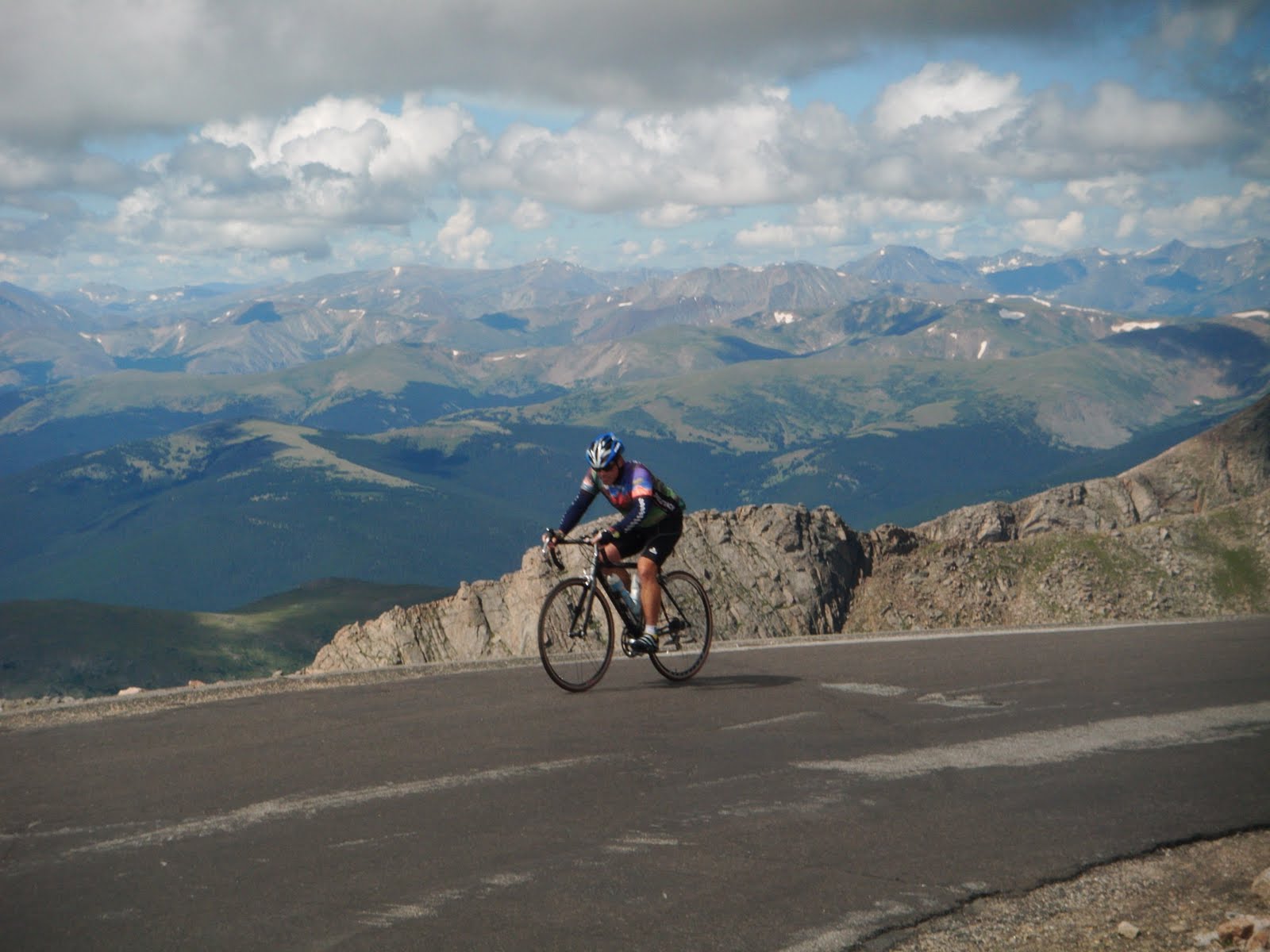
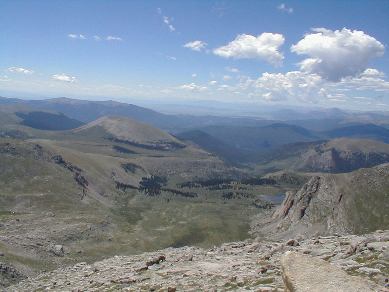
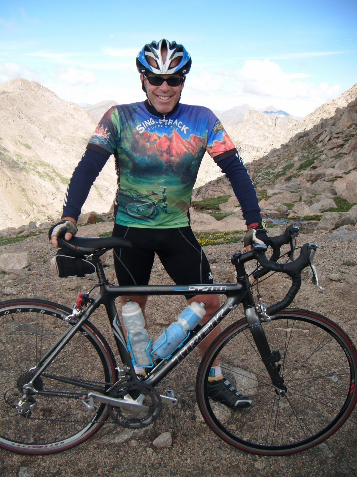
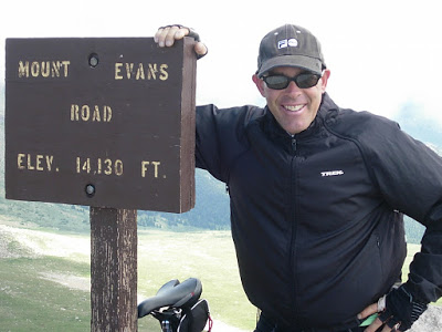
Mount Evans, Colorado
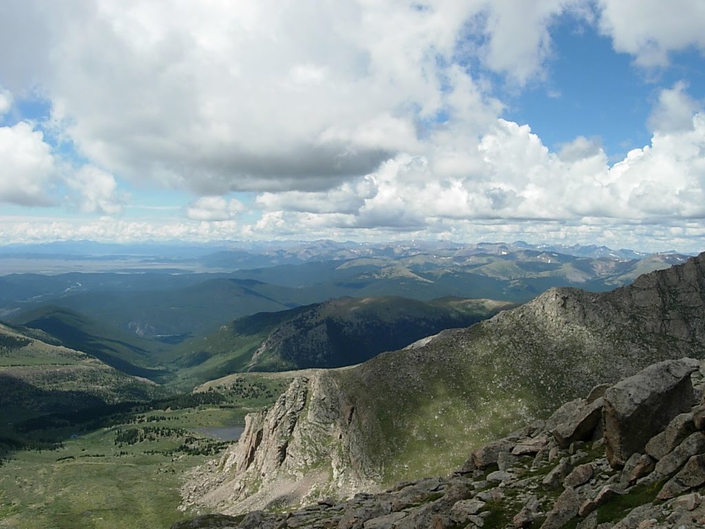
The view from Mount EvansOur first bike ride is the most elevated — a 13-mile uphill ride that starts from a toll gate and parking lot to the pinnacle at 14,265 feet on the highest paved road in North America. Here is a story I wrote for Bicycle Stories on June 26, 2011.
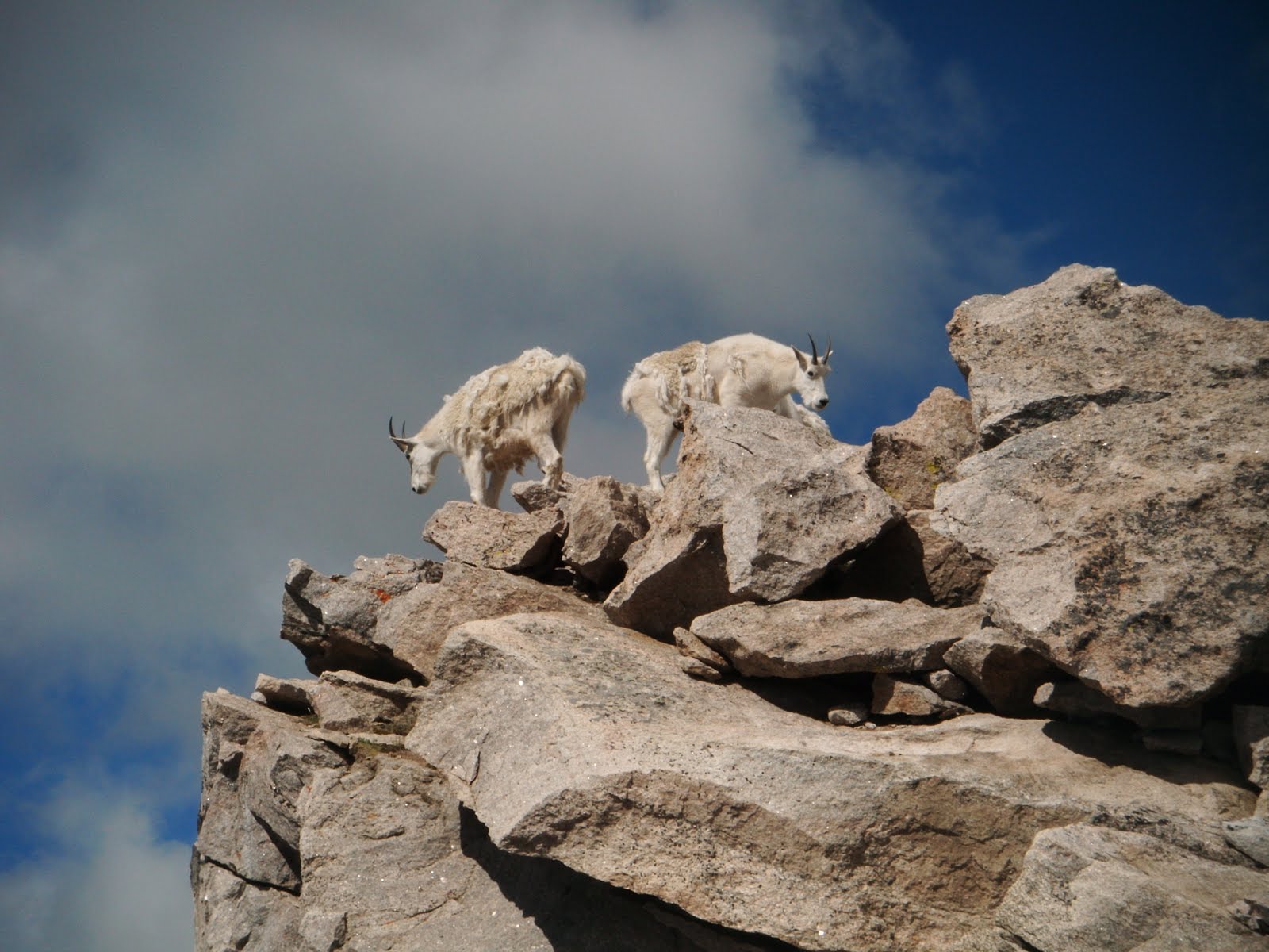
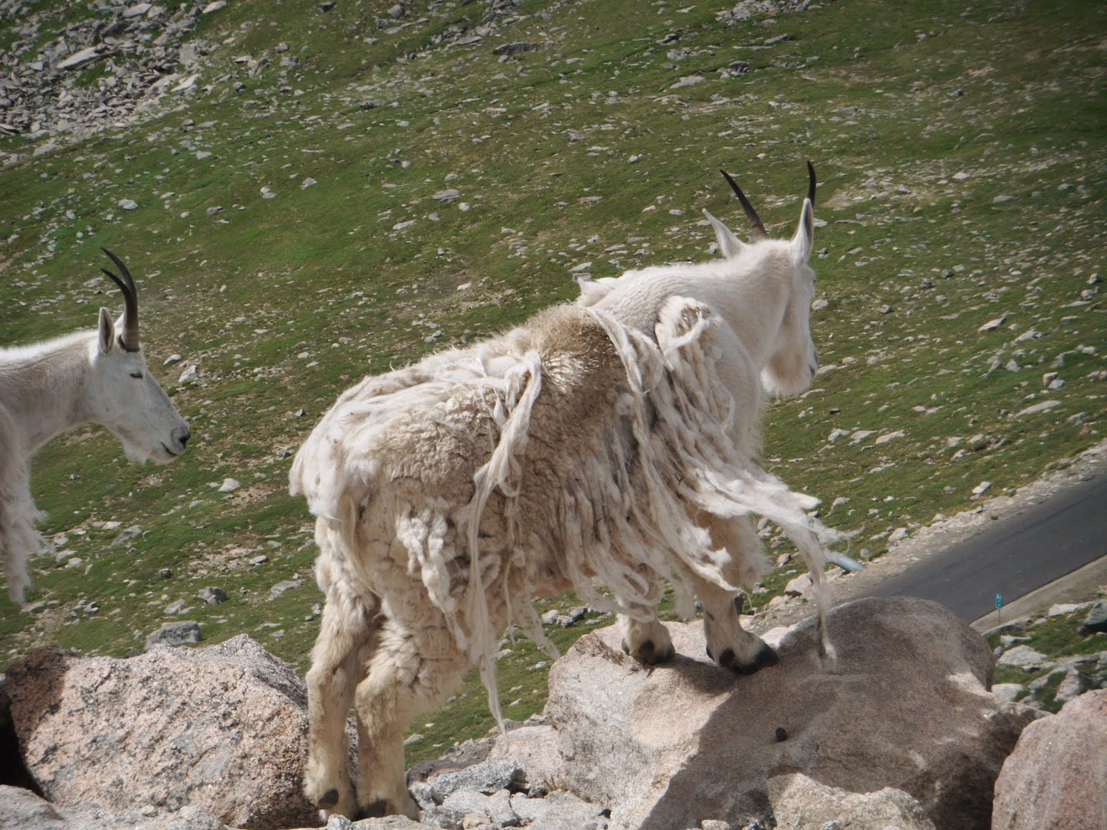
The mountain goats wear goofy expressions. The shaggy-coated bighorn sheep
pose for photos. Summit Lake is a gem.
By now, they’re are all in my review mirror – so to speak.
I’m pedaling way above 13,000 feet above sea level, en route to the summit of
Mt. Evans at 14,264.
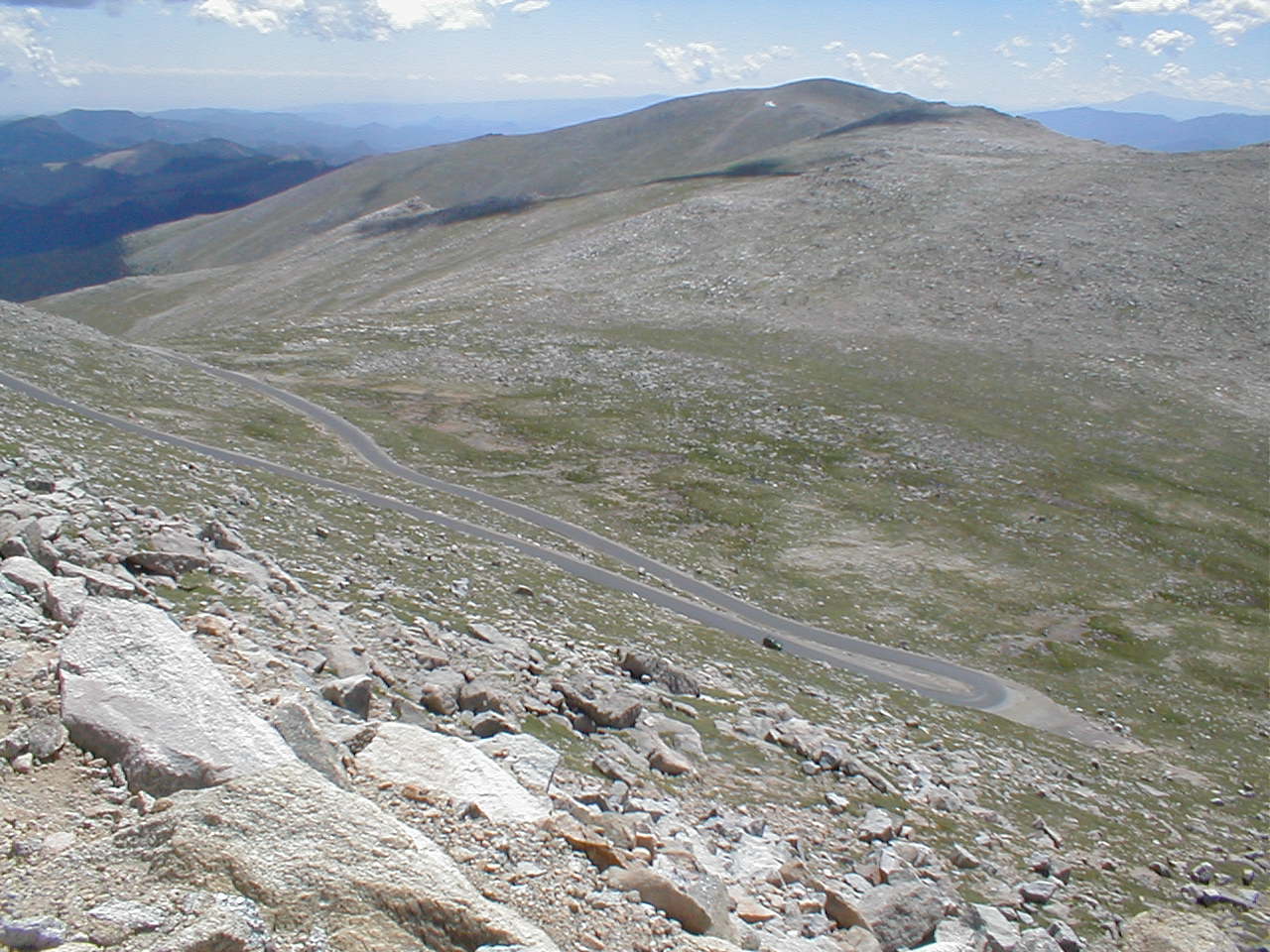
The last five miles to the end of North America’s highest paved road is
classic switch backs. I rise out of my saddle and I head into a U-curve,
working the mountain in the opposite direction. This routine will play out at
least a half-dozen times.
I’m not moving fast. Maybe six miles per hour up this steep grade. I don’t
even notice how slow I’m going. The mountain scenery is too mesmerizing to be
concerned about speed.
The slower the better, I figure. More time to gaze at the alpine landscape
above the tree line of Pike National Forest. It’s some 40 miles west of
Denver, outside of Idaho Springs.
It’s been more than two hours since I parked my car at Echo Lake, 10,000 feet
above sea level. Cars have to pay a $10 fee for the right to climb Colorado
Highway 5, which climbs some 15 miles to the peak of Mt. Evans from Echo Lake.
But I park my car at Echo Lake before I reach the toll booth and pedal in for free.
The grade for the first 10 miles is challenging, but within grasp of any
experienced long-distance bicyclist. Instead, I breathe deeply, my lungs
expanding, then compressing, to the smooth and steady cadence of my ascent.
There is an annual race up the mountain every July called the Bob Cook
Memorial Hill Climb. Riders start in Idaho Springs at about 7,540 feet and
reach the 14,265-foot summit in about 10 minutes shy of two hours. Not bad.
Today is an early July morning in 1998. I have to start early because the
weather can turn ornery after high noon.
It’ll take about two hours to reach the summit, and less than 45 minutes to descend.
There is snow in places along the road. After five miles, I catch up with a
woman on a bicycle who works in the Boulder DA’s office.
We chat about the infamous Jon Benet Ramsey case as we pedal side by side. The killer of the little Boulder girl has never been caught.
I suggest she go ahead because I want to go slow and absorb the sights – the
undulating valleys below, swaths of pine forests and the jagged peaks to the
southwest.
The mountain goats and the bighorn sheep are hams. It’s show time and the
tourists with their license plates from coast to coast can’t snap off
photographs fast enough.
As I approach Summit Lake, elevation 12,500 feet, I marvel at this road.
Sure, it can only be open between Memorial Day and Labor Day. But it’s
smoother than most Denver city streets.
The state began construction of a road to the Mt. Evans summit in 1917 and
workers took a decade to complete it. It was totally paved by 1930.
The road led to a restaurant and gift store at the summit in 1940, but a
propane explosion wiped out Summit Lodge in 1979.
Nobody was killed. Its concrete frame still endures.
These days, thin-air entertainment comes in the form of a little hairy critter called the marmot.
These whistle pigs dig burrows next to the road for easy access to people — and their food.
I stop at Summit Lake to take photos and chat with the handful of visitors
who have stopped to take in the lake buffeted by snow-covered walls of rock.
A ring of mountains, carved by a glacier, is the backdrop for the lake.
Wildflowers fill a grassy area between the road and the lake.
I mentally prepare to tackle the final five miles, which are more difficult
because of the steeper grade.
I pass a runner. Yes, on early summer mornings you will find runners striding
the 15 miles from Echo Lake to the peak.
The final five miles must take 40 minutes. The peak’s first sign is the Mt.
Evans Meyer-Womble Observatory, the highest operating observatory in the
West, standing tall at a prolific 14,148 feet.
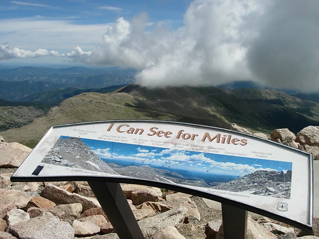
Finally, I pull into the parking lot. By now, dozens of cars have reached the
top. It’s exhilarating up here. It enlivens your soul. There are no other
places to look up at – just tilt your head down to forests and valleys and
mountainsides.
I’m not tired. Just the opposite, in fact. I practically skip around the
parking lot to a sidewalk that yields views that capture miles and miles of
landscape.
It can snow and sleet in July, so I unravel a windbreaker and wear it as I
stroll to the remains of the restaurant and gift store. It’s a mere shell, but I study the concrete walls in one moment, then stare at the mountain
terrain in the next.
Kids are frolicking on rocks that lead go the official peak next to the parking lot. It’s quiet up here, with no gaudy gift stores or hot dog stands. Photography is the main endeavor.
A woman takes my photo, and I do likewise. In fact, I take several photos of
people who smile for their cameras. They are genuinely thankful.
I stay about 40 minutes until noon, knowing I’m pushing the envelope of good
weather. The descent will take a mere 45 minutes.
I keep the jacket on. In fact, I don tight cotton gloves knowing I will hit
speeds of 40 miles per hour down the mountain. I hope my brakes work.
*
Zion National Park, Utah
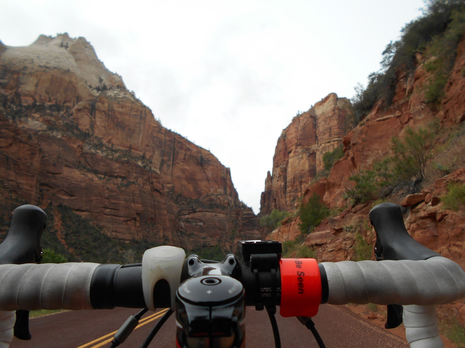
Brent Atwood relaxed on a concrete-and-slab wall, munching a granola bar. His wife, Lisa, sat beside him. And their mountain bikes leaned against the short wall.
They were at the end of the Zion National Park canyon road at a bus pickup station called the Temple of Sinawava, where the famed Narrows Trail and Virgin River Gorge are a short distance away and walls of red earth soar thousands of feet into the sky.
Atwood, a northwest Las Vegas Valley resident who is retired from the golf industry, visits Zion Canyon at least once a month with his wife.
They love to bike the 17-mile round-trip from the entrance to the end and back, mostly on a road that is off-limits to cars from April to October. Only shuttle buses and cars with lodge passes are allowed on the two-lane road that meanders through a stunningly beautiful canyon that makes Zion National Park an indelible memory for its millions of annual visitors.

The beefy bicyclist still doesn’t understand why more Las Vegas Valley residents don’t drive the 170 miles — about three hours — to Springdale, Utah, the growing gateway community that leads into the national park.
“We have lived in Vegas since the ’80s, and when I tell people I’m going to Zion, their reaction is always, ‘Where is Zion?’ I tell them, ‘It’s very close.’ ”
■ ■ ■
Well Mr. Atwood, more and more people are discovering Zion National Park.
From 2005 to 2013, annual visitor attendance ranged from 2.5 million to nearly 3 million, U.S. National Park statistics show.
But in 2014, the number of visitors shot up to more than 3.2 million, with 2015’s numbers projected to shatter last year’s mark. In March, the number of visitors hit 481,150 — a record for that month.
And Springdale, Zion’s host town, is growing to accommodate the surge in park visitors. More hotels, more art galleries, more restaurants and more sports gear stores.
“Eventually, this place will be a Sedona (Ariz.),” said a lone worker in Zion Outdoor Gear & Clothing, where he was manning the cash register.
While waiting for dinner at the popular Oscar’s Cafe, I wandered across the street to a jewelry shop aptly named “The Place Across the Street,” where owner Tim Campbell informed me that two new motels — La Quinta and Hampton Inn — have been built and another 44 lodging units will be added across from his store.
“March visitors were up 30 percent from last year and we’re on target for 4 million people this year,” Campbell said.
■ ■ ■
On this cool and cloudy May Saturday, I’m staying at the new La Quinta.
Pets are free and so is breakfast from 7 to 10 a.m. It was $224.68 with taxes for a Saturday overnight.
There are many lodging alternatives, from Desert Pearl Inn and Under the Eaves Inn to bed-and-breakfasts.
There are plenty of cool restaurants, galleries and outdoor gear shops, including several that rent bicycles, in Springdale. The community food market called Sol Foods even has bicycles hanging from the top of the walls, kind of like Trader Joe’s in Summerlin. One of the bicycles in Sol was an old Schwinn Sting Ray, so how can you not like this place?
Indeed, Lisa Atwood loves Springdale. It has a more quaint vibe than Tusayan, Ariz., the gateway town into the Grand Canyon’s South Rim.
She and her husband happened to be visiting Springdale in March when they stumbled onto the community’s St. Patrick’s Day parade. Even with Springdale’s tourist growth, the Atwoods like the folksy flavor.
“Springdale still has a small-town feel. The parade had a firetruck. They were throwing candy to kids on the sidewalk. They do the small-town stuff,” said Lisa Atwood, who works for the Southern Nevada Water Authority.
Brent chimed in, “The parade even had farm tractors.”
■ ■ ■
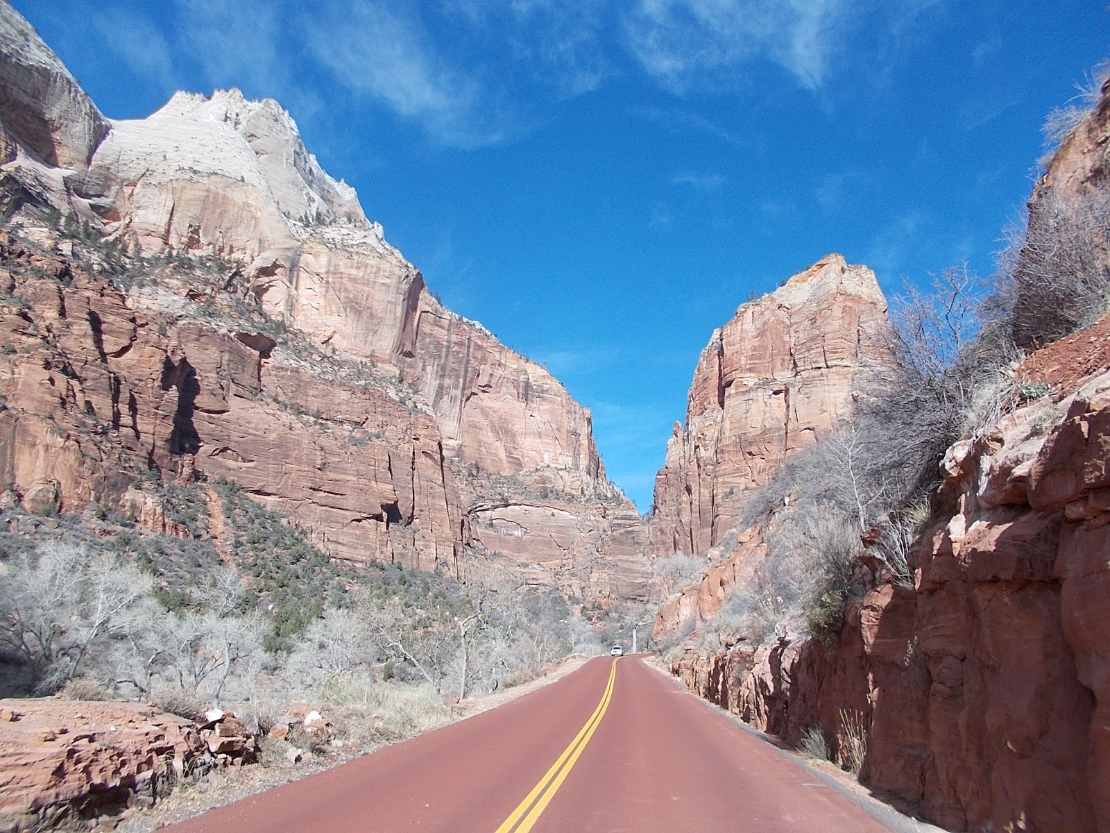
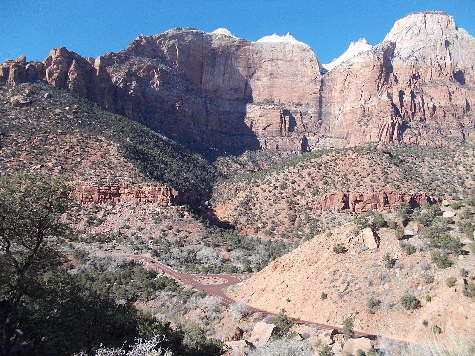
I’m here to ride my bicycle in Zion National Park, where the closed main canyon road makes biking a spectacular way to soak up the natural wonders.
The riding is casual and not taxing. At the entrance, elevation is about 3,950 feet, and by the time you finish, about 8 miles deep into the park, the altitude is only about 500 feet higher.
Bicyclists share the entrance road with motorists for about 2 miles, but a left turn on to the main canyon drag allows you to leave most cars behind. If you hear a shuttle bus rumbling behind you, safely slow down, stop and move off the road to allow the bus to pass. The bus drivers will not pass you if you continue to ride and they get upset if they have to drive behind you.
Generally, you have the road to yourself, except for other bicyclists and even walkers strolling along the pavement. And the shuttle buses.
As I pedaled up a modest hill, I enjoyed meeting two bicyclists from Las Vegas heading back to Springdale.
First was Rachelle Ivens, an ultrasound tech who adored experiencing the park by bicycle.
“You can feel it,” Ivens said.
Then, her pal, D LaFountain, a hotel-casino valet on the Strip, followed up on her bike. The bicycle, she said, gave her the autonomy to explore any section of the roadway.
“You can stop when you want to stop. It’s a better experience than the shuttle,” LaFountain said. “You can’t beat mother nature.”
■ ■ ■
While the Zion Canyon Scenic Drive is the headliner, don’t forget to check out another road that doesn’t draw as much publicity.
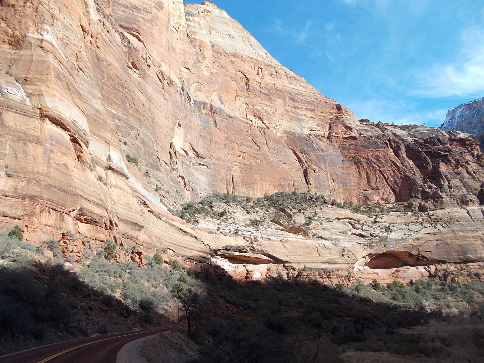
It’s the Zion-Mount Carmel Highway, which starts off as a series of switchbacks for a few miles before it reaches a 1-mile tunnel that is off-limits to bicycles. If you’re on a bike, sometimes you can hitch a ride with a friendly motorist, or just drive with your bike and park at a turnout past the tunnel because this road is spectacular to pedal for the first 5 miles past the tunnel.
I highly recommend that you lock your bicycle near the guard station right after the end of the tunnel for a 1½-mile round-trip hike on the Canyon Overlook Trail. You will enjoy majestic vistas of the switchbacks and the land formations extending into the sky some 7,000 to 8,000 feet.
Back on the road past the tunnel, keep on biking to Checkerboard Mesa, a fascinating rock formation that does look like several checkerboards knitted together.
Speaking of hiking, if you do not want to ride a bicycle, you can certainly saunter your away along Zion’s nearly two dozen terrific trails.
One of Zion’s most well-known trails is the Zion Narrows Hike, a classic slot canyon trail that has attracted tens of thousands of hikers through the years to stroll through the waters of the Virgin River, which could be up to your ankles or waist depending on the season.
And don’t forget the classic Angels Landing, a twisty switchback trail that takes you about 1,500 feet above the canyon floor.
■ ■ ■
I look at Zion as one-third of the holy trinity of big-league geography in the Southern Utah-Northern Arizona area that’s accessible to Las Vegas, which also includes the Grand Canyon and Bryce Canyon National Park.
On this trip, I stayed overnight. But I have also done one-day field trips to Zion.
If you get up early and leave at 7 a.m. in Las Vegas, you could drive three hours and start there at 11 a.m. local time because Zion is in the Mountain time zone. You have the entire day to play, hike, bike, shop and eat and you can leave at 8 p.m. and be home in Las Vegas at 10 p.m. (regaining that hour because of the time zone shift).
It’s worth the three hours in a car to get there. Eat at Oscar’s. Bike along the main canyon road. Stroll on the canyon overlook near the tunnel. Zion is worth the trip.
*
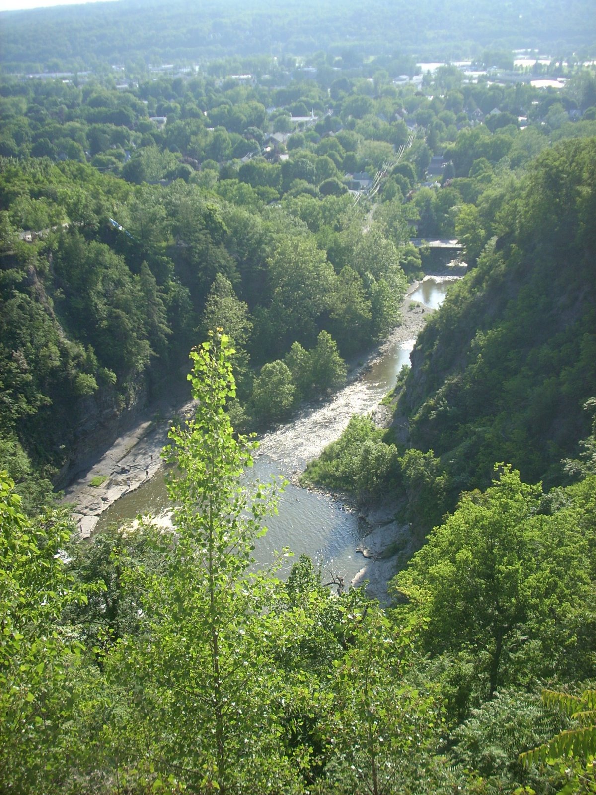
Catskill Mountains, New York
To me, it’s my own little space shuttle ride, a trek to the cosmos and back. All in one day. And all it takes is a few gallons of water and a whole lot of granola bars.
I’m not exactly breaking the sound barrier at a steady 15 mph clip on my Cannondale R300 road bicycle, but it’s still my rocket to the Catskills, the mountain range made famous by such Americana superstars as Milton Berle and Rip Van Winkle.
It’s a 95-mile course I’ve plotted to and through the Catskills from my home in New Paltz, a college town about 75 miles north of New York City. We have our own local mountain range outside New Paltz called the Shawangunks – a ridge famous for its white rock, dwarf pine trees, mountain lakes and some of the best rock climbing on the East Coast.
But today – an unusually hot day at 85 degrees for Tax Day here in the Hudson Valley – I’m off for a visit to a much younger mountain range, the Catskills.
Pull up your bike shorts, strap on the helmet and grab a bike seat. We’re going to the mountains and you’re coming along for the ride.
The morning heat burned away a dreary fog as I follow the flattest stretch of the journey along the slow-moving, north-flowing Wallkill River to a small town called Rosendale. The Wallkill is not exactly a raging bull of a river. In fact, the Wallkill makes the Withlacoochee River look like a white-foaming Colorado rapid.
Rosendale hit the big time decades ago when its limestone deposits were mined for cement, which was sent to New York City to help erect the Brooklyn Bridge and Statue of Liberty. These days, it’s a funky and quirky place of some 6,000 souls with a fun Main Street that plays host to a rare single-screen movie house. Rosendale’s biggest day of the year? How about the International Pickle Fest every November.
“We’ll never be a . . . Woodstock. But we’re no longer the town that has 18 bars on Main Street,” the town’s ex-supervisor, Jeannie Laik, once told me.
It’s in Rosendale where I pick up Route 213, a wonderful two-lane road that will lead into the heart of the Catskills. The white-rock Shawangunks peeter out a few miles south of Rosendale and Route 213 skirts the northern edge of that small range.
Now it’s time to take the Route 213 flyer up to the Catskills. I love this road. The Rondout Creek runs parallel to 213, a two-laner offering gentle twists and hills amid the old rocks that yielded cement decades ago.
A few miles up the road it’s a small hamlet called High Falls, then a few miles after that it’s Stone Ridge. These are very hip-sounding communities where quality of life is taken very seriously. In other words, there are some good restaurants in town.
The Gunks, as the Shawangunks are called, have a high peak of about 2,280 feet. The Catskills’ peaks are in the 3,500-foot range. The Catskills are about 10 miles away once I head out of Stone Ridge.
But here’s the thing: while pedaling on 213 you don’t even realize you’re entering the Catskills and heading right into the heart of the range. That’s the beauty of it all: the gradual ascent amid fields, rugged houses and leafless tree lulls you right into the range. There’s no dramatic climb, just a tranquil journey into the mountains.
It’s in the town of Olive where you feel as though you’re in the Catskills. Viewsheds – don’t you just love that term? – offer a peak at the jutting upward slopes of the Catskills. The mountains are here. You have arrived.
I happen to like Olive for two reasons.
First, the town holds an annual Olive Day, which includes my favorite competition – the frog-jumping contest. I recall a youngster, eager to spur his entry to victory, stomped his foot to get the frog going. Well, one particular stomp of the foot missed its mark and sent this boy’s frog to the disabled list – well, let’s just say the big disabled list in the sky.
Second, Olive has a very cool town logo. Just about every Hudson Valley town has an emblem that includes a river, a mountain and a tree or some combination of those. Olive’s emblem shows a bird with – what else? – an olive branch in its beak. Maybe the Middle East talks should come to Olive.
The oohing and ahing over the Catskills’ rugged scenery begins at the Ashokan Reservoir, part of New York’s vast upstate reservoir network.
Mountains form a ring in the backdrop of the reservoir, which is mighty low these days because of a draught that’s drying up the Northeast water supply. It’s downright bizarre to feel this hot – this is mid-summer heat – and see no leaves on the trees yet. The buds are out, but only the evergreens offer color in the forests.
The views are spectacular. You’re far away from the mountain summits that the Catskills look like giant brown humps cutting a tranquil outline against a clear sky. You just want to sit and stare.
This being the post 9-11 era, there are cops guarding a causeway that leads over the Ashokan reservoir, which supplies New York City’s drinking water. They’re listening to the Yankees play the Red Sox on Patriots Day, when Boston plays host to the Bronx Bombers for an 11 a.m. ballgame.
“Who’s winning,” I ask the cop.
“The bad guys.”
Route 213 has ended and I’m on Route 28A along the reservoir’s southern edge heading for Route 28, a main valley drag that bisects the northern chunk of the Catskills. I reach Boiceville at Route 28, home to the local high school in the area, and head for Phoenicia, where I’ll take a lunch break at the 37-mile mark of the trek.
There are Catskills peaks on both sides of Route 28. This road’s water mate is the Esopus Creek, a swift-moving waterway running alongside 28. It’s the beauty of cycling – seeing how creeks are connected to valleys and how they both rest in the underbelly of the mountains on both sides.
Phoenicia is a classic Catskills village that’s become a tourist destination. Old-time outdoor stores selling heavy plaid shirts stand near yuppie cafes where well-coifed waitresses serve city slickers. Emblematic of the mountain town gentrification is a bar I used to frequent called the Sportsman Bar and Grill. It’s become a chi-chi Mexican restaurant. But at least they kept the old sportsman statue out in front.
There’s still the place that rents tubes for people to go tubing on the Esopus Creek, that foamy creek that runs along Route 28. It’s quiet today in Phoenicia and this April day still feels like July, when the place would be crawling with tourists.
Phoenicia is surrounded by mountains. Look down Main Street and It’s time to refuel because I’m about to climb 10 miles on Route 214 to the Catskills forest preserve near the ski towns of Hunter and Tannersville. I gobble up bagels and granola bars and quaff a liter of water.
The best part of the trip is that there’s no malls. There’s no suburbia. I don’t get why people drive miles so that they could walk from their car on an asphalt ocean the same distance if they parked in a city and walked to their shops.
I study drivers’ faces when I ride. Motorists are just not a happy lot, I’m afraid to say. They either look sad or mad, but never happy. Sometimes in my more whimsical states of mind — which is often when I’m pedaling – I think the quickest way to end war and disputes is to abolish religion and national borders and give everyone a bicycle. Riding a bike is one of those precious few acts that both young and old enjoy for the sheer love of pedaling, seeing and getting around. The expressions on their faces are the same – joy.
But I digress. It’s probably because it’s time to climb some serious mountains. It’s 10 miles straight up to the lofty foot peaks of the state forest preserve. I pass through small incorporated hamlets such as Chichester, Lanesville and Edgewood. There’s a post office here, a church there, small rundown homes next to smartly-manicured vacation houses.
I’m not going very fast. Maybe 6 or 7 mph. But it’s a steady zen-like spin as I ascend the mountain. There’s a certain purity to climbing. You pedal, you move and there’s no way around it. No BS-ing, no negotiating, no fast-talking the mountain to let you up without digging deep and settling into a steady cadence. It’s why I love riding up hills. It’s not who you know, or how much money you have, or who’s your papa – it’s just you and the uphill.
Route 214’s water partner is Stony Clove Creek, an Esopus Creek tributary. The road cuts a jagged course through the mountains. Again, the double-takes: all those trees look mighty naked without leaves.
Near the top of the climb is the state forest preserve, a healthy chunk of raw woods with trailheads and scenic lakes off the road. This is the Catskills – hearty, inspirational and rugged.
After a three-mile descent – man, it’s sweet cruising 40 mph down the long hill – I finally hit Route 23A near Hunter and Tannersville. It’s disorienting. If it feels like summer, then how come I’m seeing snow-covered ski runs falling down Hunter Mountain? It’s about 50 miles into the ride as I approach Tannersville and Haines Falls on Route 23A.
Tannersville is a hybrid of a ski town and local hangout. It’s isolated enough to have a car dealership close to downtown. There’s a mish-mash of bed and breakfasts, convenient stores, old homes crying out for a paint job and local businesses like family-run pharmacies.
Ah, the big descent to Palenville. It’s four miles of sheer 40 mph downhill past evergreens, trees with buds ready to burst and rocky waterfalls. I hit Route 32 and follow this main artery to the 70-mile mark at Saugerties in north Ulster County.
I’m out of the Catskills. The hills now roll instead of rollercoasting you up and down and around. In fact, Saugerties sits on the Hudson River and the Catskills are the stuff of books and maps and pictures in the bookstores of Saugerties, a village of 5,000 that’s kind of a New Paltz Lite without the state college. Joining the bookstores are cafes and antique shops lining a pleasant Main Street.
For a major pit-stop, I stop into a McDonald’s, the first one I’ve seen on the trip and I ask for a water bottle refill. And another. And then another. The skinny teen-ager with his McDonald’s uniform shirt falling outside of his pants can’t believe it. The kid’s never seen anyone ask for water in the joint. I read the New York Daily News. The Yankees-Red Sox series dominate the sports section. I skip over the Middle East strife coverage. There’s time to catch up after the bike ride.
Now, it’s time for the flatlands. I follow a road south that runs parallel to the New York State Thruway to Kingston, the county seat. It’s late afternoon and I’m in the homestretch of the ride. Kingston is a city about 25,000 with varying old neighborhoods. It stretches from its uptown stockade area to its waterfront on the Rondout Creek, which meets the Hudson River. You remember the Rondout – that’s the creek that flows through Rosendale.
I hook into Route 32 in Kingston for the final 15 miles back to New Paltz. It’s a climb to get out of Kingston, but once I’m past the Ulster County public safety center on the edge of the city, Route 32 flattens out and I head for Rosendale, that old cement town, which is about halfway between Kingston and Rosendale.
The Gunks come back into view, and the Catskills are a dream-like blur on the northern horizon.
By now, the zen-like pedaling rhythm is kicking in. I pass Bloomington, Rosendale, Tillson and New Paltz is the next stop. It’s early evening now and the miles are slowly passing – 91, 92, 93 – as I reach the New Paltz village line.
The sun is setting behind the Shawangunks and a pink corral shade is backlighting the mountain ridge. I soak up the view.
I’m still in bike shorts and jersey when I stride into my kitchen and put a pot of water on the over burner to boil. Pasta is on the menu.
The post-ride feast has begun.
*
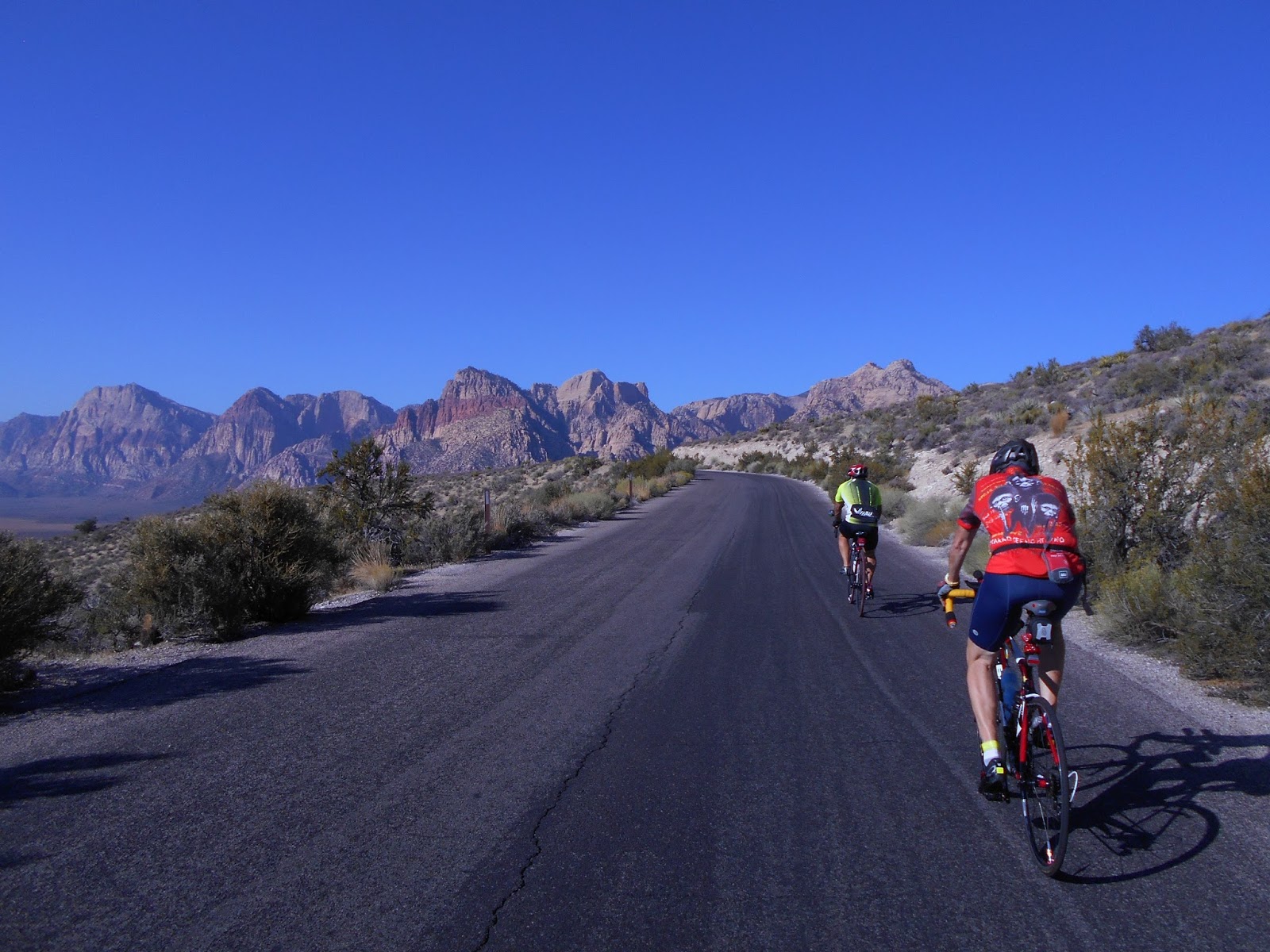
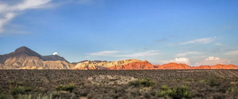
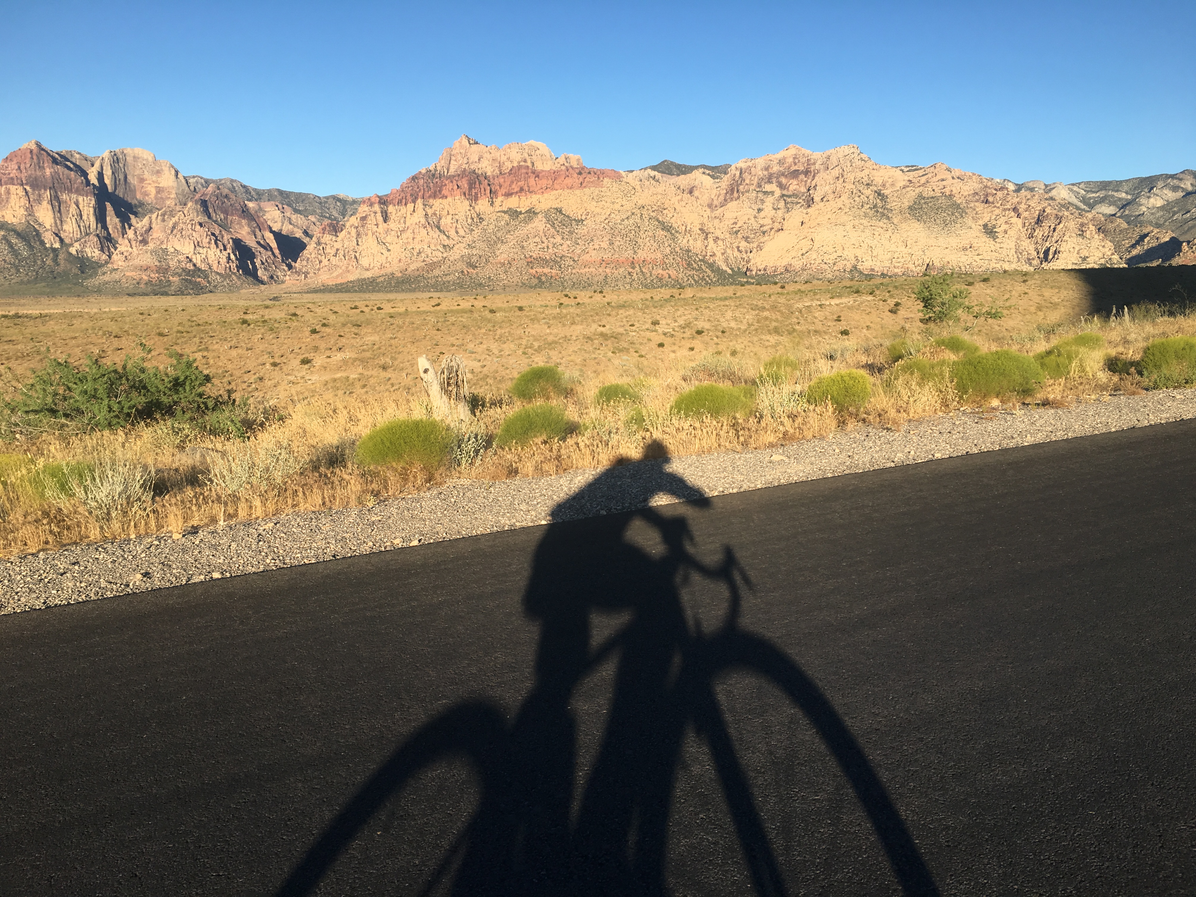
Red Rock Loop, Nevada
When I returned to Las Vegas in June 2017 to launch LVSportsBiz.com, I was still recovering from a distracted motorist in St. Lucie County, Florida driving his car into me from behind and nearly killing me March 7, 2017.
I made a vow to myself.
I promised to ride a bicycle on the Red Rock Loop outside the metro Las Vegas area and climb to the 4,771-foot perch before finishing the nearly 13-mile toll road that meanders into the foothills of the Spring Mountains before returning to Nevada state route 159.
It was an emotional bike ride that early June 2017 morning. I reached the small parking lot at the top, peered at the landscape with the big red strips and sobbed. I was back.
I wrote about this journey in my book, Long Road Back to Las Vegas: Jow Las Vegas and the Golden Knights healed a journalist’s wounds.
This Red Rock toll road has great meaning. I’ve met some of my closest friends wile bicycling this loop. There’s my New York pals Scott Sofferman and Anthony Rossi — bicyclists pedaling the loop on separate days when I met those guys.
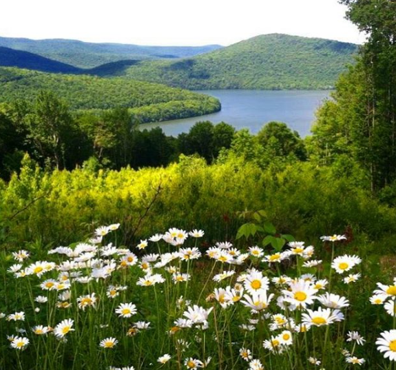
This past spring the wildflowers were in full bloom, in full color benefitting from a wet winter.
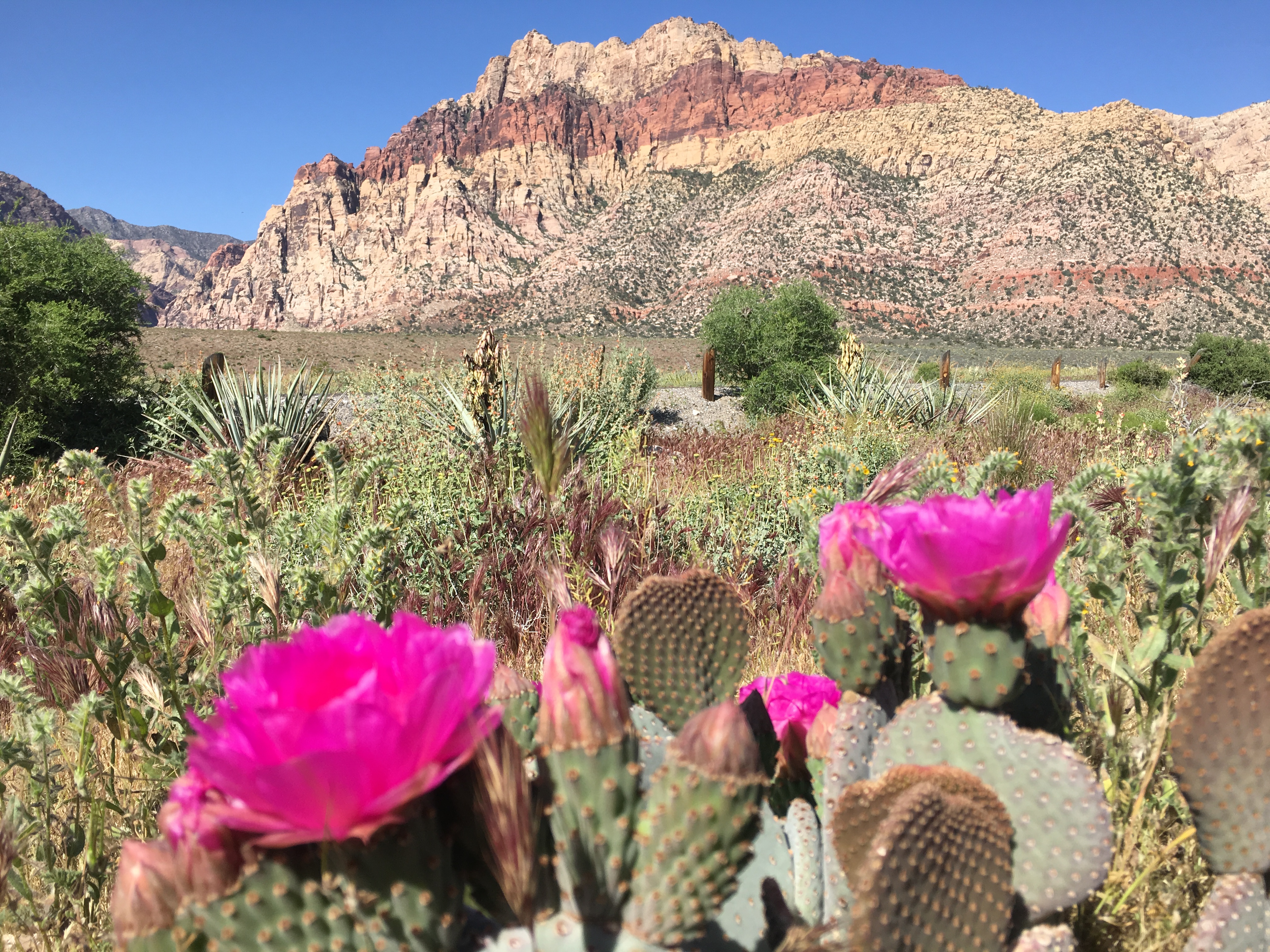
It’s stunning that outside the sprawling suburb of Summerlin 20 miles west of the Strip, you have so much open, undeveloped federal land that’s a spiritual paradise for me. In the hot summers of Las Vegas, I leave my Summerlin apartment before 6 a.m. to enjoy 80-degree weather and a spiritual retreat into Red Rock Canyon
Maybe I’ll meet you there. I have met so many here.
*
Hudson Valley, New York
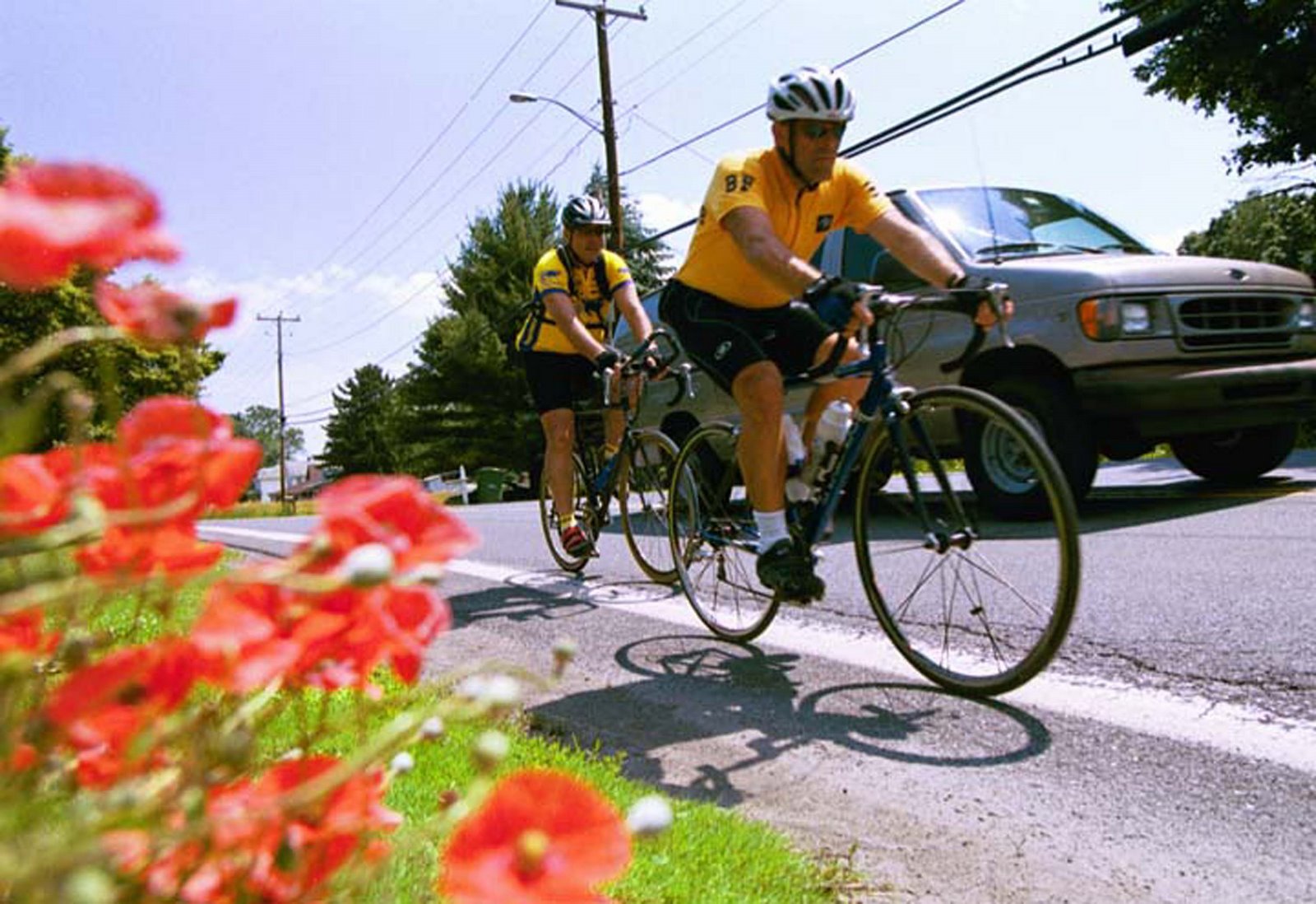
The Hudson Valley north of New York City has a special place in my bicycle heart.
I’ve bicycled all types of rides up and down the shores and mountains along the mighty Hudson.
The segments were often 50-mile rides along the family of Route 9 — from 9W to 9D.
The most amazing Hudson Valley ride was a 158-mile, one-day bike ride I did in memory of amazing long-distance bicyclist Bill Fox of Middletown, New York. Bill died tragically in a bicycle crash in the Hudson Valley in June 2002.
Remarkably, I met Bill a single time — in April 2001 when I was biking a crazy 115-mile route in the Hudson Valley in New York as part of a goofy newspaper business story on the Stewart’s convenience store chain. I had a chance meeting with Bill at a Stewart’s store in Goshen. Bill was biking from Middletown, NY into New York City to catch a concert and I was on my zany bike Tour de Stewart’s for the story for a daily newspaper called the Middletown, NY-based Times Herald-Record.
Bill and I were both long-distance marathon cyclists who used our bicycles as much as vehicles of meditation as we did as machines that carried us hundreds of miles. So he was a kindred spirit. We both loved sharing our infectious love of bicycling with anyone willing to listen. We were cycling evangelists. The un-saved people called us bicycle enthusiasts.
I included Bill in that Tour de Stewart’s newspaper story in 2001.
The next time I wrote about Bill was when I wrote a newspaper story about his death in June 2002.
I saw an obit in my newspaper of a “Bill Fox” on the Times Herald-Record and the obit included a line about his love for bicycling.
Not knowing that this was the same Bill Fox I met a year earlier at that Stewart’s store during our bike rides, I interviewed’s Bill’s wife and wrote a story about Bill’s amzzing life and the way bicycling turned his life around after he was overweight. It was during the interview that Margaret Fox, Bill’s wife, informed me that Bill enjoyed meeting me during the bike rides one year earlier and he actually kept the story after it ran in the Times Herald-Record.
Margaret had triggered my memory — yes, her husband was Bill Fox, the amazing Bill Fox who I met a year earlier during that Stewart’s store ride.
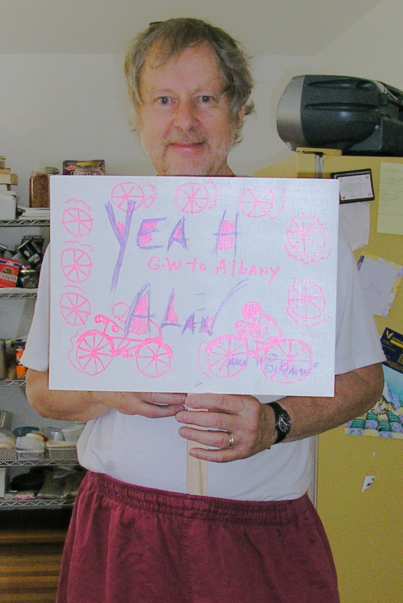
Three years after Bill’s death, I did a personal memorial bicycle ride for Bill by biking those 158 miles from the George Washington Bridge at New York City to the state capitol in Albany. Along the way, I phoned in messages to amazing blogger and writer Jeff Houck, who posted live reports about the 158-mile Bill Fox ride on his blog at the time.
I had dinner with Margaret Fox while I was visiting the Hudson Valley for the bike ride in her husband’s memory. A few weeks later, a package came in the mail. It was a former jersey of Bill’s. I wear it only one time a year — when I do my annual bike around Lake Okeechobee 120-mile ride. I was amazingly touched by Margaret’s gesture.
So many people joined the ride in different ways. Take my Hudson Valley newspaper pal, Wayne Hall, who I met along the way.
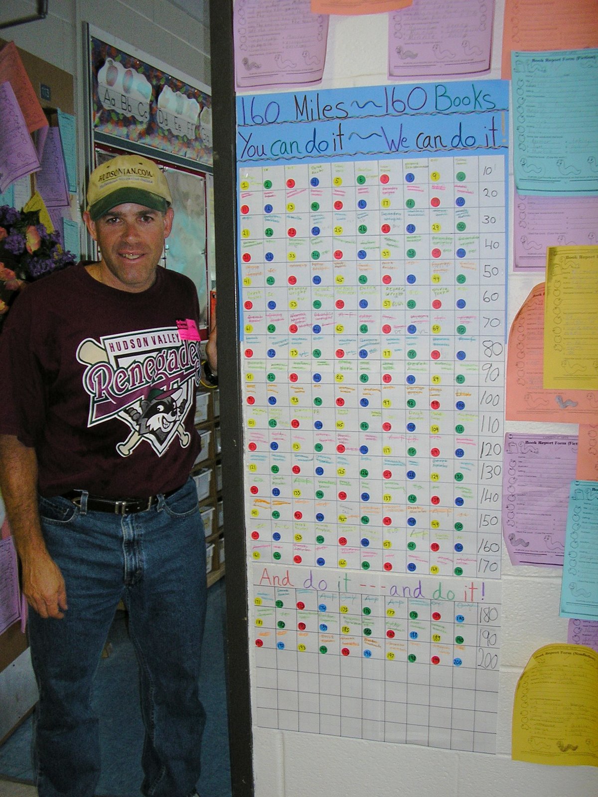
There was also Rosemary Evans, a beautiful teacher in the Newburgh area who had her students read 160 books for every mile I biked from New York City to Albany.
And then there were the friends meeting me at the steps of the state capital in Albany when I completed that 158-mile ride in memory of the amazing Bill Fox.
The Hudson Valley is a beautiful and inspiring natural setting. I’m so sorry Bill lost his life on a bicycle. I do know he likely soaked up every minute of life while pedaling hus bicycle in the Hudson Valley when he was alive.
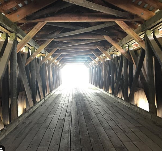
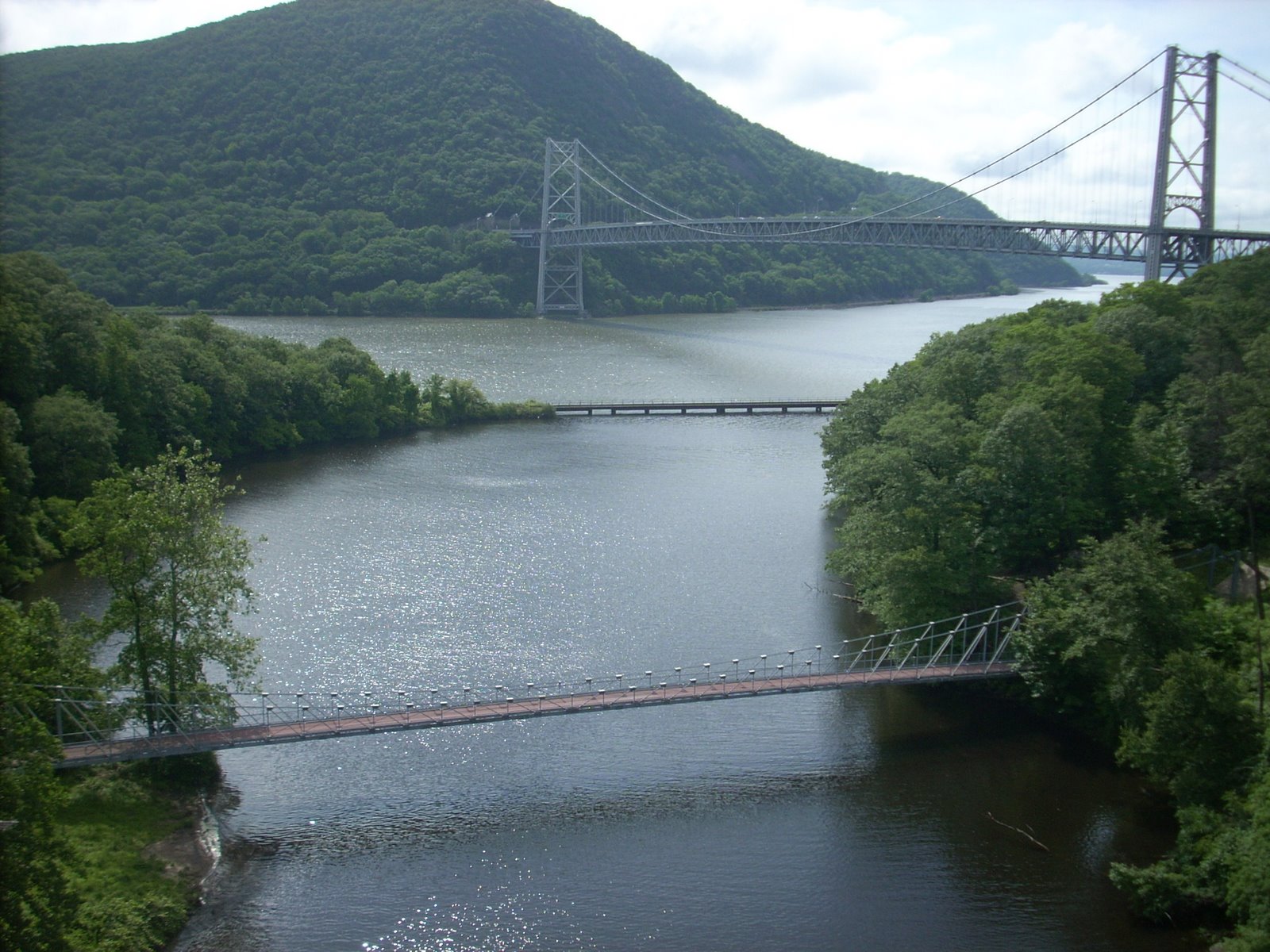
During my memorial bike ride for Bill Fox along the Hudson Valley, but great bike friend Chris O’Connell joined me for the middle 80 miles of the ride, from Bear Mountain to Catskill.
Here’s a picture of Chris at a Hudson Valley landmark that is no longer around.
The brotherhood of bicycling endures.
*
Big Sur, California
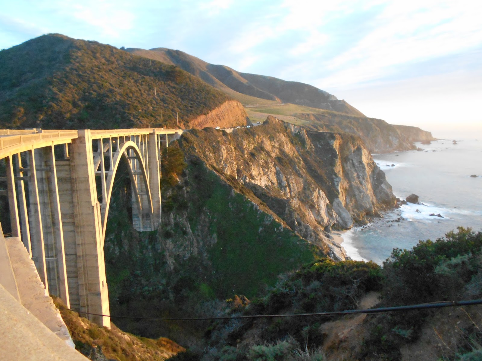
Bicyclist Bill Walton, who used to play college and professional basketball at quite a high level, raved about Big Sur.
It’s central California north of San Luis Obispo and south of Monterrey.
And it’s wooded, rolling hills and cliffs overlooking the Pacific offer spectacular vistas.
I agree with Bill — it’s an amazing place to ride a bicycle.
So, do that one.
*
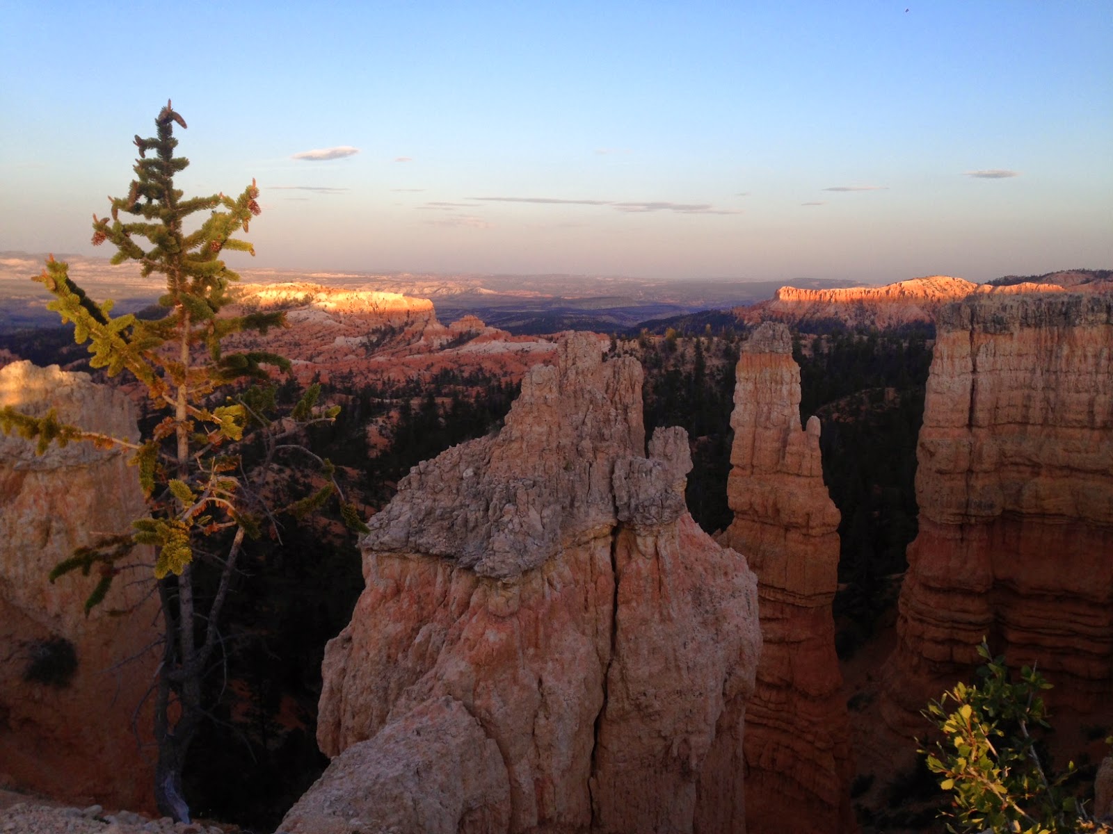
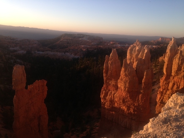
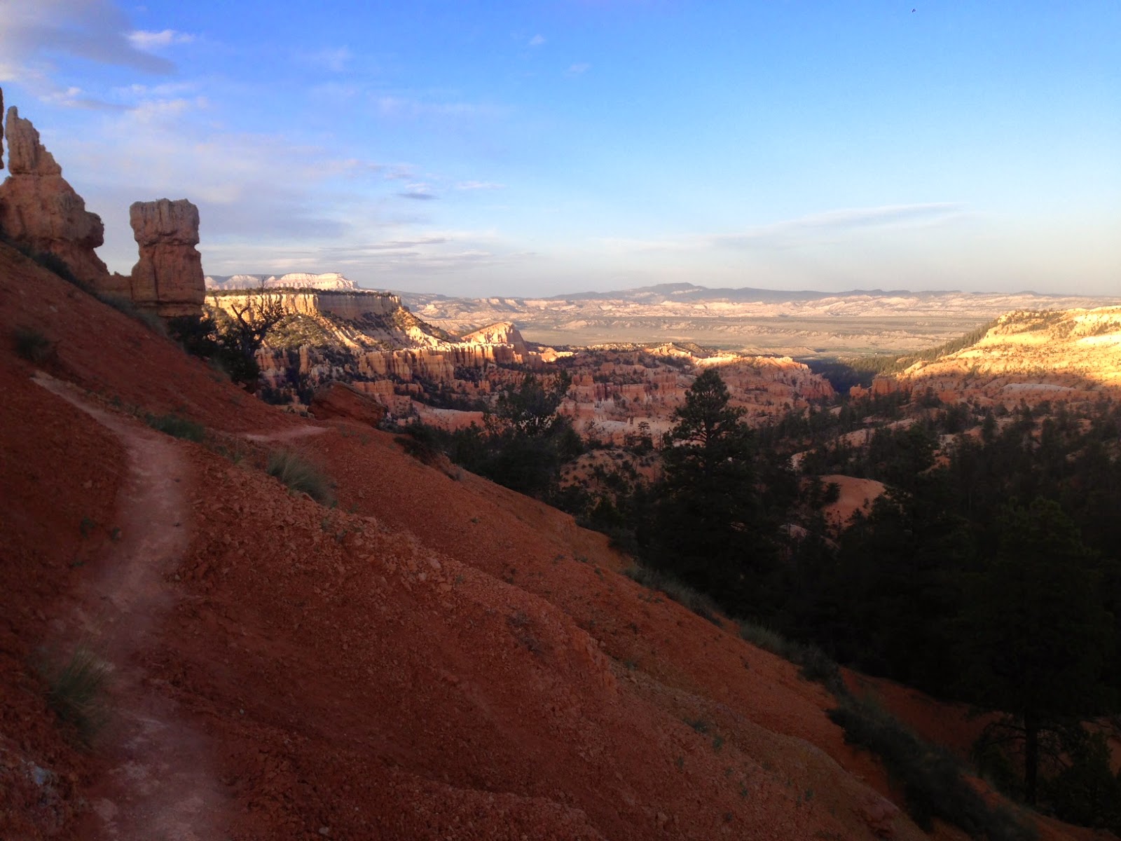
Bryce Canyon National Park, Utah

(This a June 2014 travel story about a Utah bicycle tour experience I did courtesy of Escape Adventure, a Las Vegas-based bicycle tour company owned by Heather Fisher and Jared Fisher, who just completed a herculian 18-day cross-country bicycle ride from Seattle to Maine.)
After a tasty dinner of enchilada pie packed with sliced zucchini, yellow squash and bison meat, two touring bicyclists — Elizabeth from Utah and Nancy from California — strolled from their campsite at Bryce Canyon National Park to the canyon rim for a peek at the sunset.
The tips of the canyon’s famed spires called hoodoos were illuminated as the pair carefully followed an 8,200-foot-high path for inspiring views of the national park.
Elizabeth and Nancy enjoyed the day-end visual spectacle as touring road bicyclists with Escape Adventures, a Las Vegas-based company that has taken guests for mountain bike and road bicycle tours in places from the Tetons to the Grand Canyon to Oregon’s Pacific Coast for the past 22 years. Escape Adventures stages 40 to 70 tours throughout the West every year, ranging in price from $795 to $2,500. Custom tours can be tailored to customers’ requests.
Jared Fisher of Blue Diamond, who owns bicycle stores in Las Vegas and Moab, Utah, launched Escape Adventures more than two decades ago. For this bicycle tour in mid-June, Fisher used his vast knowledge of Southern Utah for a seven-day road trip that includes the Holy Trinity of national parks — Bryce Canyon, Zion and Grand Canyon.
I joined the tour for the first three days to get a taste of a scheduled bike trip. I have bicycled solo across the country twice and have created urban restaurant bicycle tours in Tampa, Fla., but I wanted to see what it was like to pedal on an organized commercial tour.
FRIENDLY GUIDES
I have been meaning to explore Southern Utah’s amazing landscape of high country and red rock formations, and Escape Adventures proved to offer the right balance of tour guidance and bicyclist autonomy.
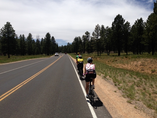
My two guides were a can-do pair of twentysomethings whose love for bicycling came through in an enthusiastic and caring fashion. Merrick Golz, 27, and Zephyr Sylvester, 23, led rides, cooked three unbelievable meals a day and struck the right balance of advising guests in a friendly manner without talking down them. Both are avid mountain bicyclists with strong road cycling skills.
Golz and Sylvester formed a great team, making sure tires were properly inflated and gently reminding us to stay hydrated while doling out anecdotal tips on the road conditions and elevation changes.
The duo prepared meals ranging from French toast in the mornings to homemade pizzas complete with peppers and cilantro at lunch and appetizers and tasty dinners at night, including a splendid grilled salmon on the tour’s first evening.
During our rides, Golz and Sylvester each took turns cycling with the three of us — I joined Nancy and Elizabeth on the daily rides in Southern Utah — while the other drove the Escape Adventures van and trailer.
Escape Adventures offers two options for biking guests to launch a tour. In this case, Nancy met the Escape Adventures crew at The Element boutique motel next to the Las Vegas Cyclery bike shop for the trip to St. George, where they rendezvoused with Elizabeth and myself at The Crystal Inn off Interstate 15.
CEDAR BREAKS
While Bryce Canyon, Grand Canyon and Zion are the Big Three of national parks within a day’s ride of Las Vegas, there are other noteworthy scenic stops along the way.
The first day was a case in point. From St. George, we drove to Cedar Breaks, an 81-year-old national monument that offers a spectacular natural rock amphitheater at more than 10,000 feet.
We lunched on turkey sandwiches and soft apple cookies before we hopped on our bicycles for a 5-mile ride in the hilly terrain around Cedar Breaks, then we took a right turn for a 15-mile descent to Panguitch Lake campground in the Dixie National Forest.
The descent was amazing as I hit 50 mph thanks to the slope and tailwinds.
Sylvester, who started on the job in May 2013, said he enjoys meeting the array of guests such as Nancy and Elizabeth. Both enjoy road cycling, with Elizabeth cranking up the hills and Nancy going slower with her two trusty Nikon point-and-shoot cameras at her side.
“I meet so many cool people from every field,” said Sylvester, who grew up in Vermont and attended Whitman College in Walla Walla, Wash.
BRYCE CANYON
The first day was an easy 27 miles — and it was a pleasant start to the tour to see spectacular Cedar Breaks, which tends to get overshadowed by the higher-profile canyons such as Bryce and Zion in Southern Utah.
After zipping down from 10,400 feet at Cedar Breaks to 8,200 feet at Panguitch Lake, we cycled the second day from the National Forest campground to the quaint city of Panguitch, dropping about 1,700 feet.
I enjoyed the display of quilts down Panguitch’s main street as we pedaled through the quiet town and headed to Bryce Canyon National Park.
Before we arrived at Bryce Canyon, we pedaled through Red Canyon — a visual treat. We left the road and pedaled on a paved trail for about six miles through the aptly named Red Canyon.
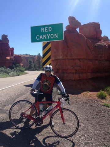
After battling headwinds from Panguitch to Red Canyon on U.S. Highway 89, we turned on state Route 12 to pedal through Red Canyon to Bryce Canyon. It was mostly uphill to Bryce Canyon. The tour’s second day involved biking 47 miles.
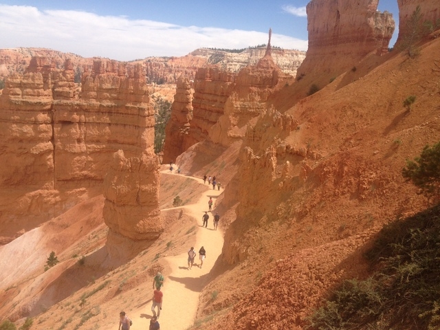
For bicyclist tourists who would like to log more miles, Golz was happy to accommodate the request. For example, Elizabeth wanted to ride some more at Bryce Canyon, so she pedaled another 30 miles or so during the afternoon inside the park, while Nancy and I decided to hike down the loop Navajo Trail at Bryce Canyon. We all met up at our park camp spot around 5:30 p.m.
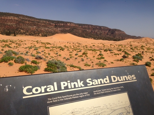
CORAL PINK SAND DUNES
My third and final day entailed trying to pedal from Bryce Canyon National Park to another underrated natural gem — Coral Pink Sands Dune State Park, some 72 miles away.
Biking back from Bryce Canyon to U.S. 89 was pleasant, as it was mostly downhill and meant another trip through gorgeous Red Canyon.
But when we turned left on the highway and headed north, we bucked ferocious 30 mph winds. The fierce winds eventually forced us to seek cover and a van ride to an alternative route, a side road miles down the road that took us back to 10,000 feet elevation and chances to see the lava rocks from ancient eruptions and get a glimpse of the headwaters of the Virgin River.
We stopped for lunch at Duck Creek at about 9,600 feet. Golz prepared two delicious pizzas and we carbed up for the rest of the afternoon of riding.
Between cycling from Bryce Canyon to U.S. 89 and then the second mountain segment, we logged 40 miles — not bad when you consider the nasty winds that forced us off U.S. 89.
We packed the bikes on the van roof and headed for Coral Pink Sand Dunes State Park, where the windblown sand that formed the dunes made for some fun routes for ATVs.
END OF THE TOUR
The organized bicycle tour was a hit. The guides were helpful and terrific chefs, while offering accurate information about the various routes.
After the third day of riding, Golz drove me from Coral Pink Sand Dunes State Park to St. George, where my car was parked.
While I ended my mini-tour, Nancy and Elizabeth continued on to the Grand Canyon’s North Rim and Zion National Park, where the two hiked the park’s well-known Narrows. In Springdale outside Zion’s entrance, the tourists stayed in an inn overnight — the only night the two were not camping out during the tour.
Escape Adventures is featuring another road bicycle tour this summer in Idaho’s Sawtooth Mountains and offers various mountain bike tours in North Dakota, Utah and Washington during the next few months.
*
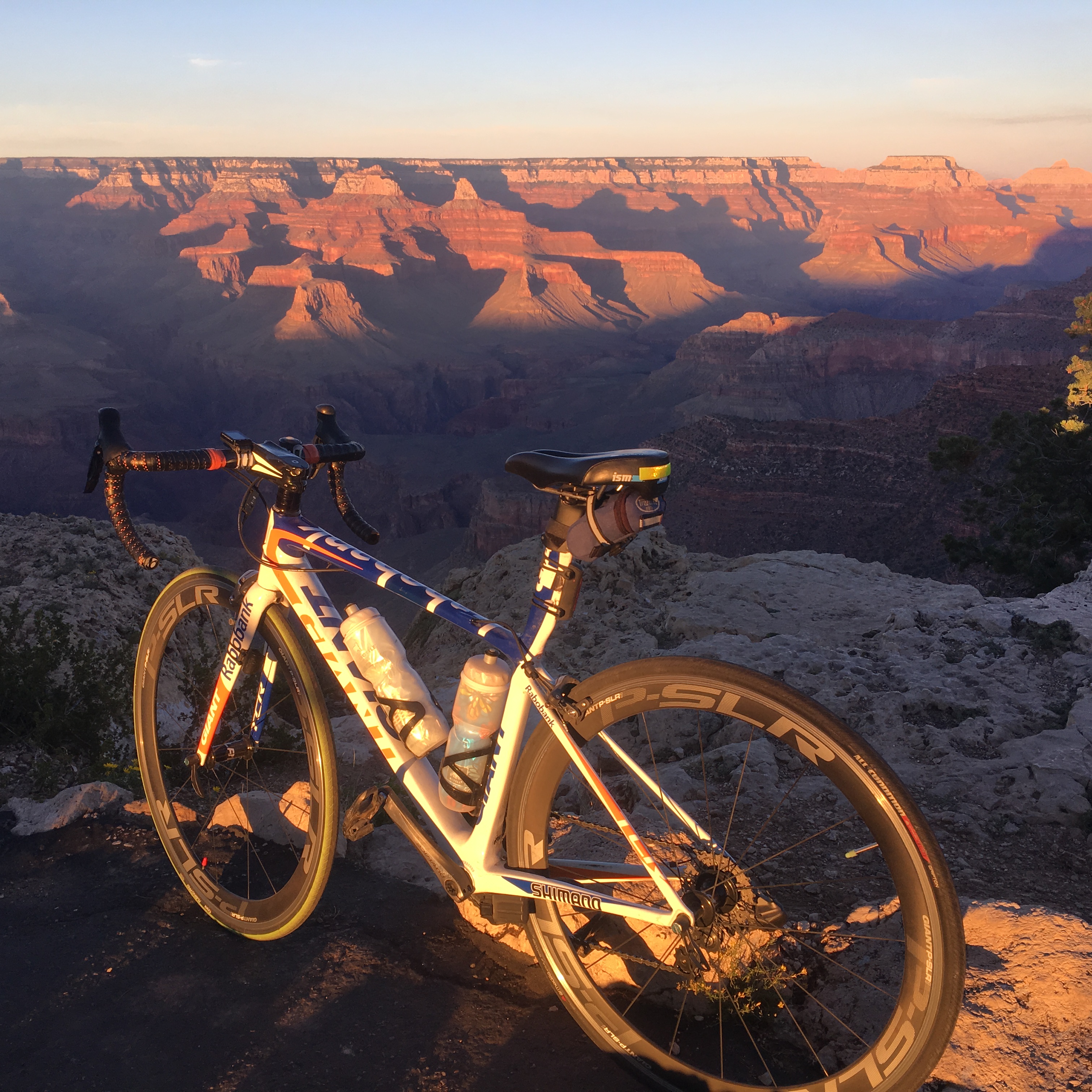
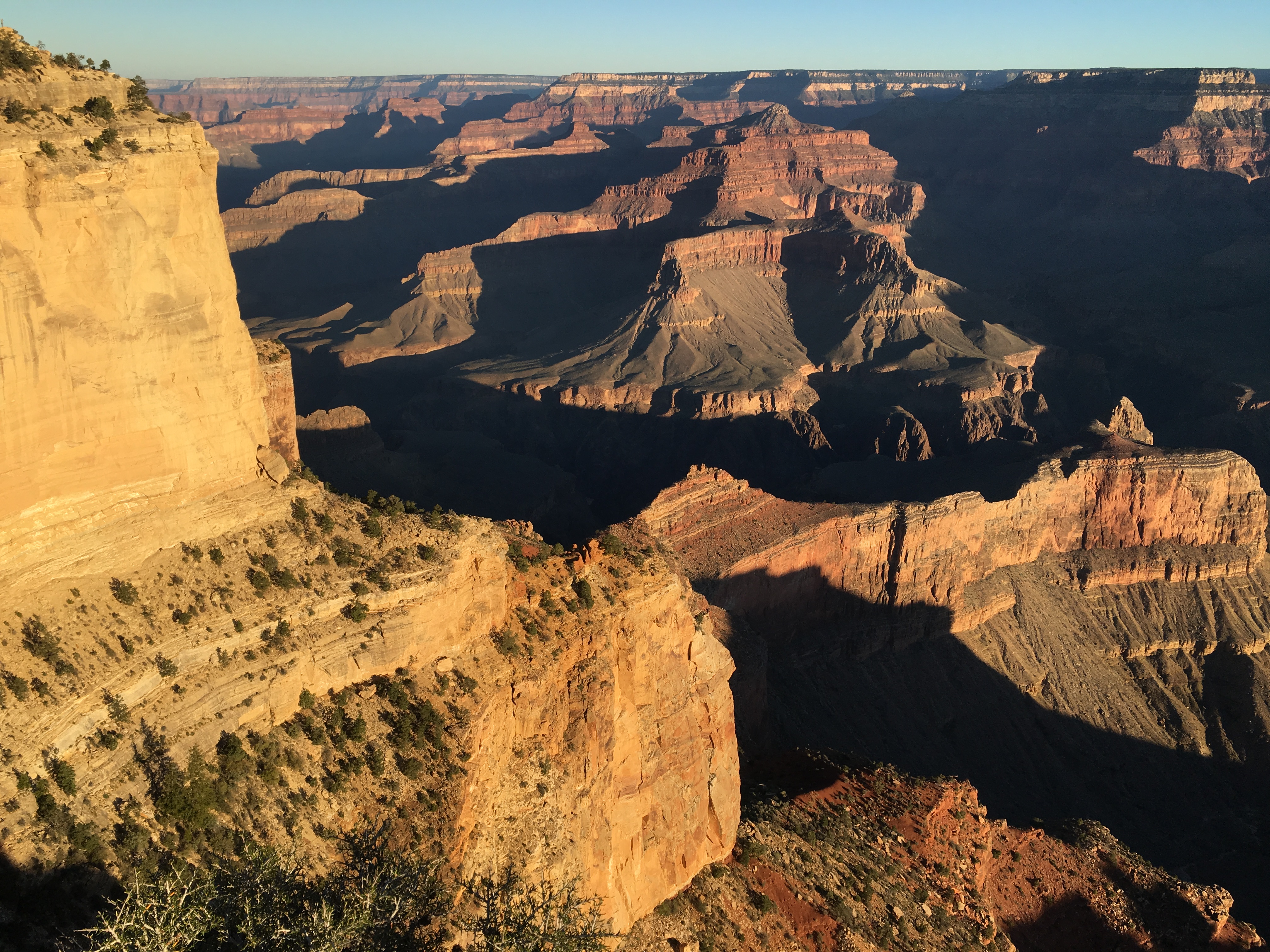
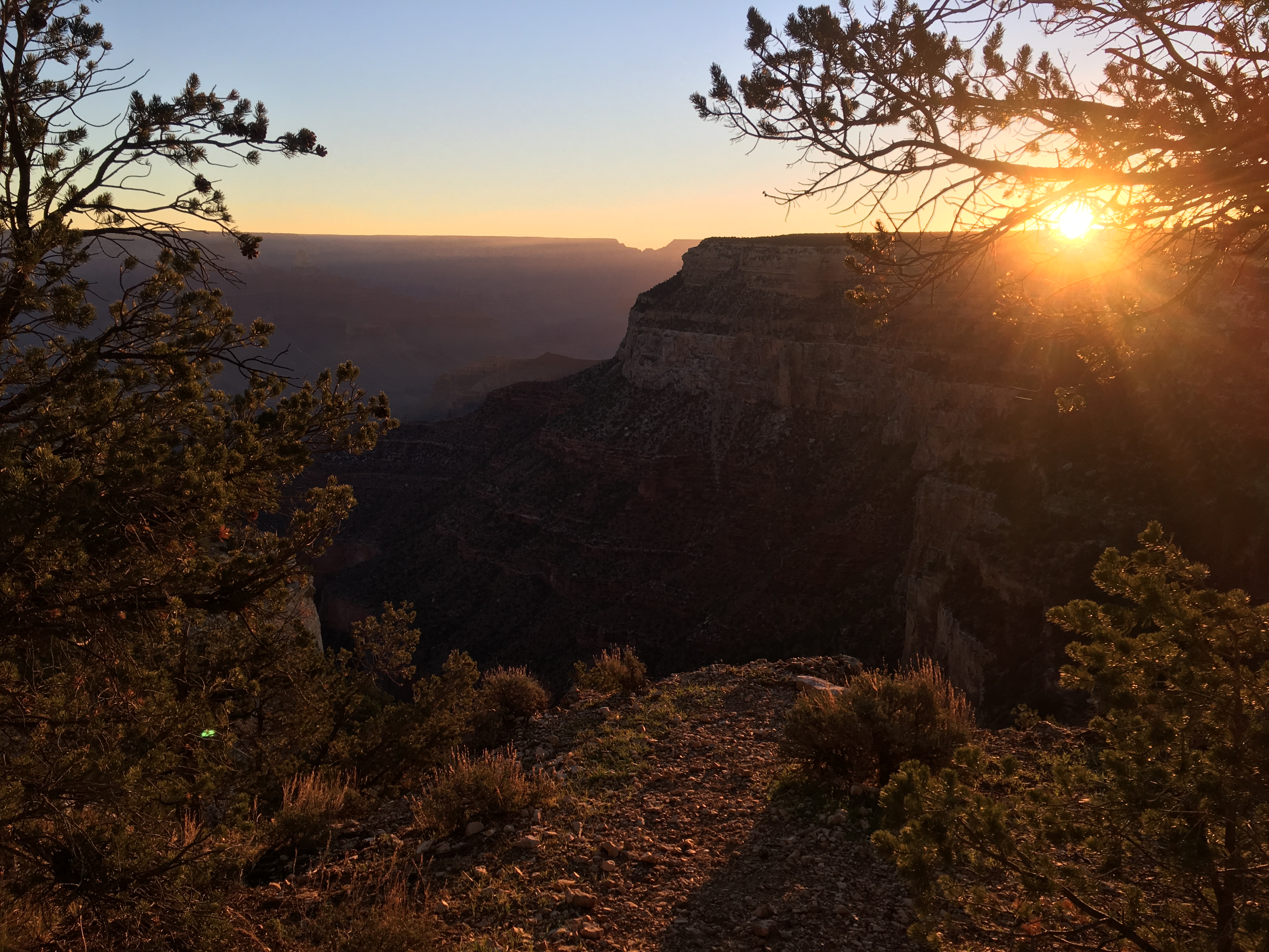
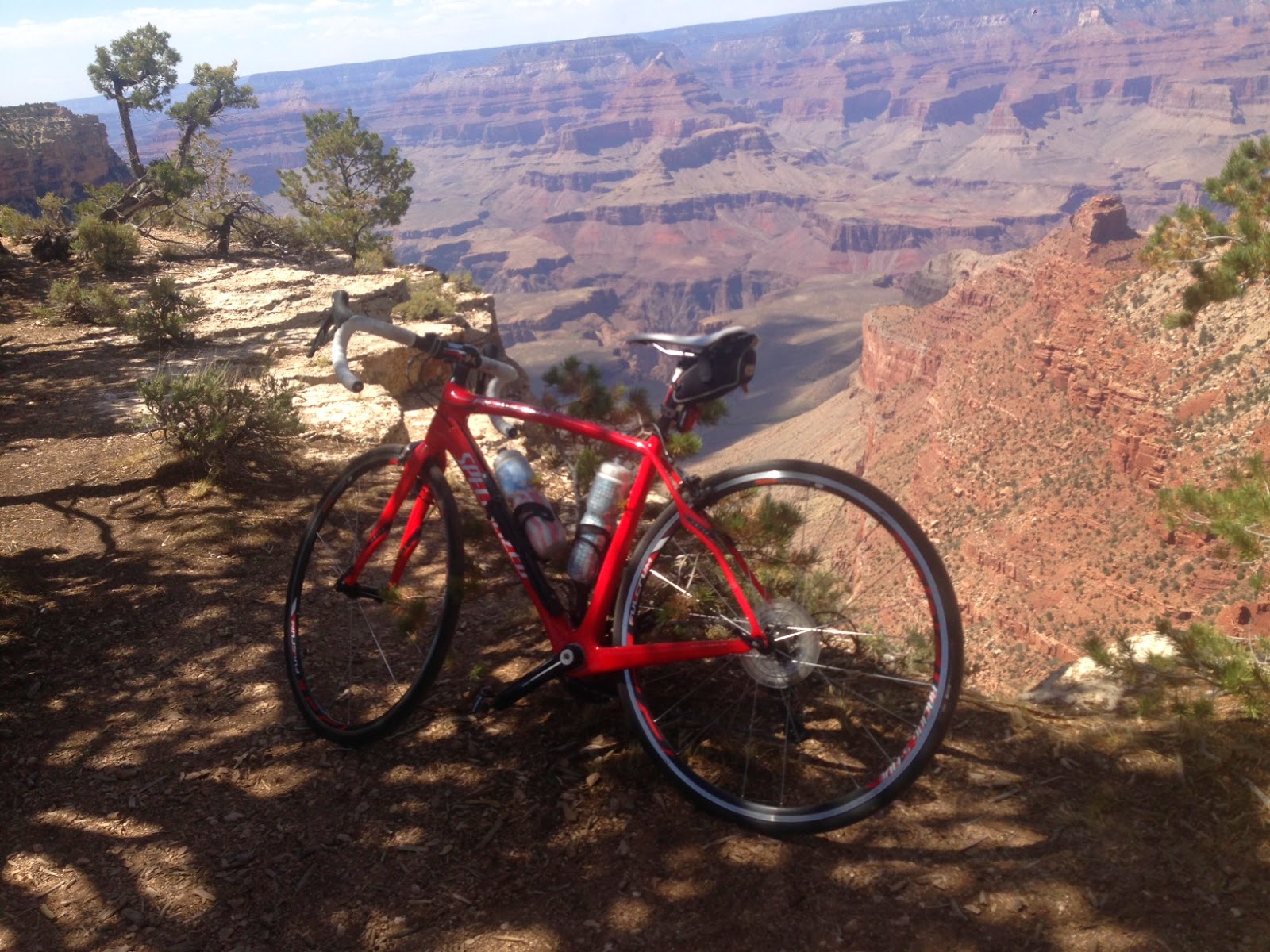
Grand Canyon, Arizona
Most people known the Grand Canyon as the place to walk along the trails near the canyon edge offering you-just-have-to-be-there mind-boggling vistas that photos just don’t evoke the appropriate wow feelings.
But the popular tourist southern rim actually has a two-lane road that bicyclists can pedal that are off-limits to tourists in cars. The only motorized vehicles are the park buses and the drivers of those vehicles expect bicyclists to pull over.
It’s a small inconvenience for bicyclists because there are small parking lots off the road with terrific access to the stunning views.
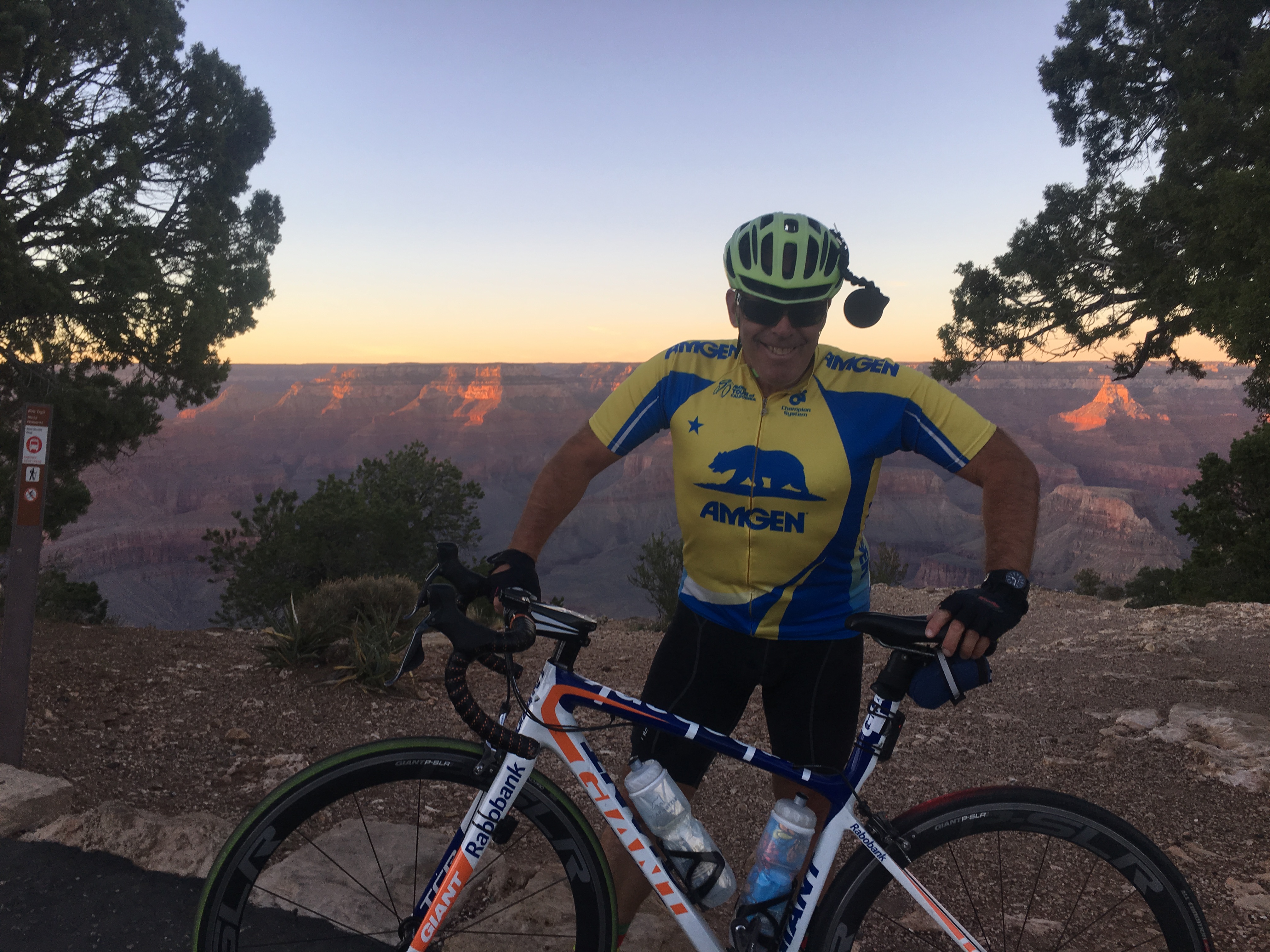
So, take your bicycle. There is a bike rental place near the visitors center where the buses come and go, too.
*
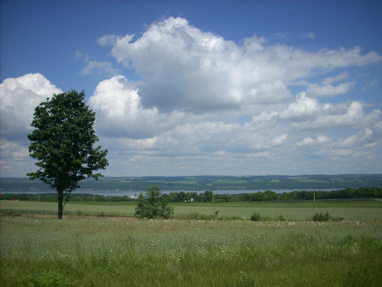
Finger Lakes, New York
I went to college in the Finger Lakes region of central New York state, an area from Rochester to Syracuse spreading south all the way to Binghamton and Corning and the Southern Tier of the Empire State.
It’s where I discovered the joys of long-distance bicycling.
The landscape was pastoral. The topography consisted of long, sloping north-south hills between the long lakes and steep drops downward to the lakes shores of Seneca, Cayuga, Keuka, Canandaigua and Skaneateles.
The small cities were timeless. They were time machines that transported you to the 1950s, where farm land and wineries dominated the scenery between the long lakes.
You can find affordable bed-and-breakfast lodging in the villages like Seneca Falls, or just roll out a camping bag in the middle of nowhere on the acres of farmland that extend forever.
Ithaca is a nice hub, with its spectacular gorges. Check out Watkins Glen, too, for its quaint village, area wineries and lovely state park.
The fall foliage is early October is over before you know it and the winters are long and brutal.
But it’s the place where I fell in love with long-distance cycling.
And it’s a very under-rated part of the country to ride a bicycle. If the weather is pleasant, you will not be disappointed.
*
Lake Okeechobee, Florida
I’m not a big fan of Florida these days. But I do have a throw a bicycle ride bone to the Lake Okeechobee Scenic Trail and roads that encircle Lake O, the Big Lake that reminds me of the timeless Finger Lakes region of New York state.
Here’s another bicycle travel story I wrote. This time on bicycling 120 miles around Lake Okeechobee in one day. I used to do it once a year on mid-November, when the threat of hurricanes had ended and the humidity began to be replaced with cooler, drier air. Here’s the read.
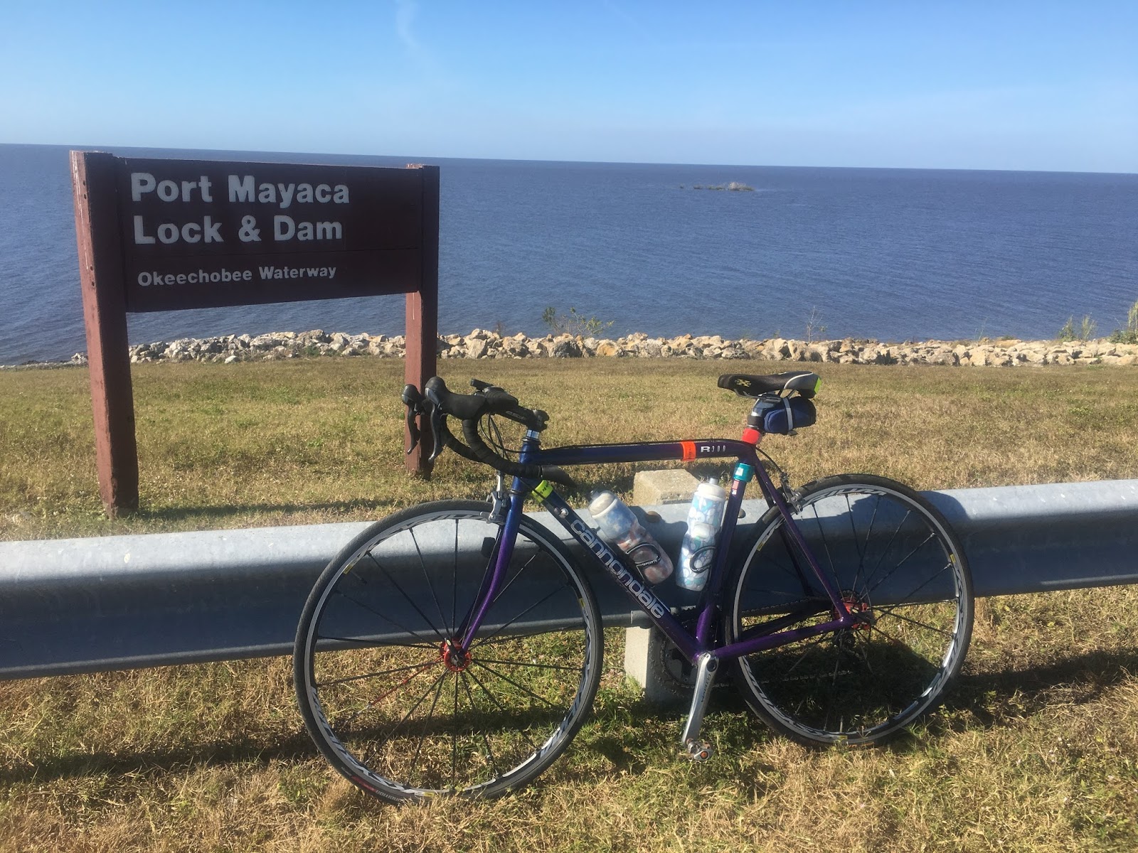
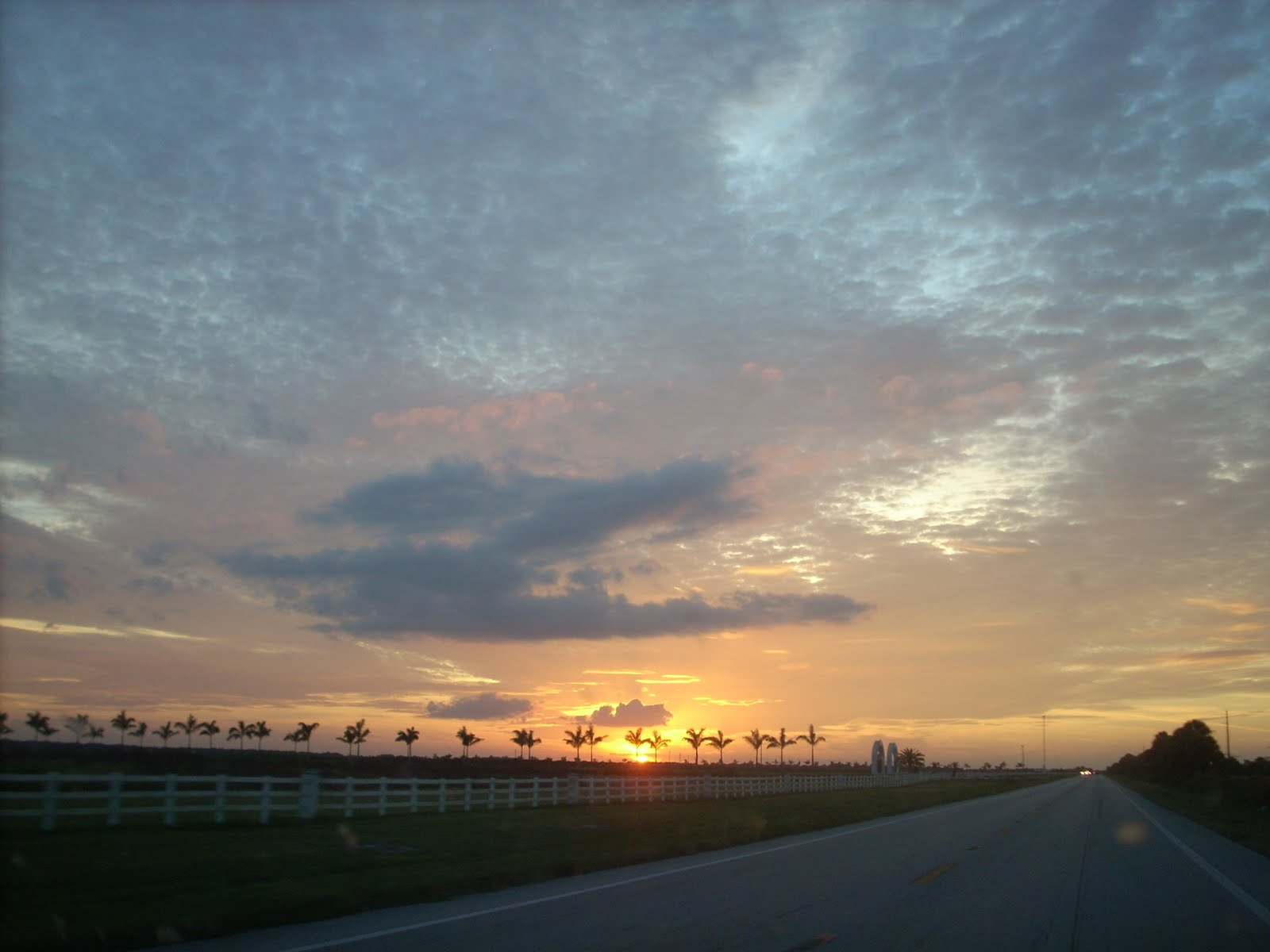
It’s just after sunrise, and the Big Lake is looking serene. A cold front that blew through is pumping cool breezes from the northeast — prime weather for a solo bicycle ride around Lake Okeechobee.
I’m standing atop the lock at Port Mayaca in southwest Martin County, poised for the counterclockwise, 120-mile, five-county loop. No pushy tourists or gaudy plazas. This is sugar, cattle and fishing country. The beauty is sublime out here, and my biggest challenge will be the derelict sugar cane stick that may escape the 18-wheelers.
“We’re the real Florida,” says Shirley Jarriel of Pahokee Main Street, a group that tries to drum up visitors for the town. “We call ourselves Florida’s other coast.”
I start the daylong journey at the Port Mayaca perch because it offers a scenic peak at the lake I’m about to encircle. I soak up the view for inspiration. Then I hit the road.
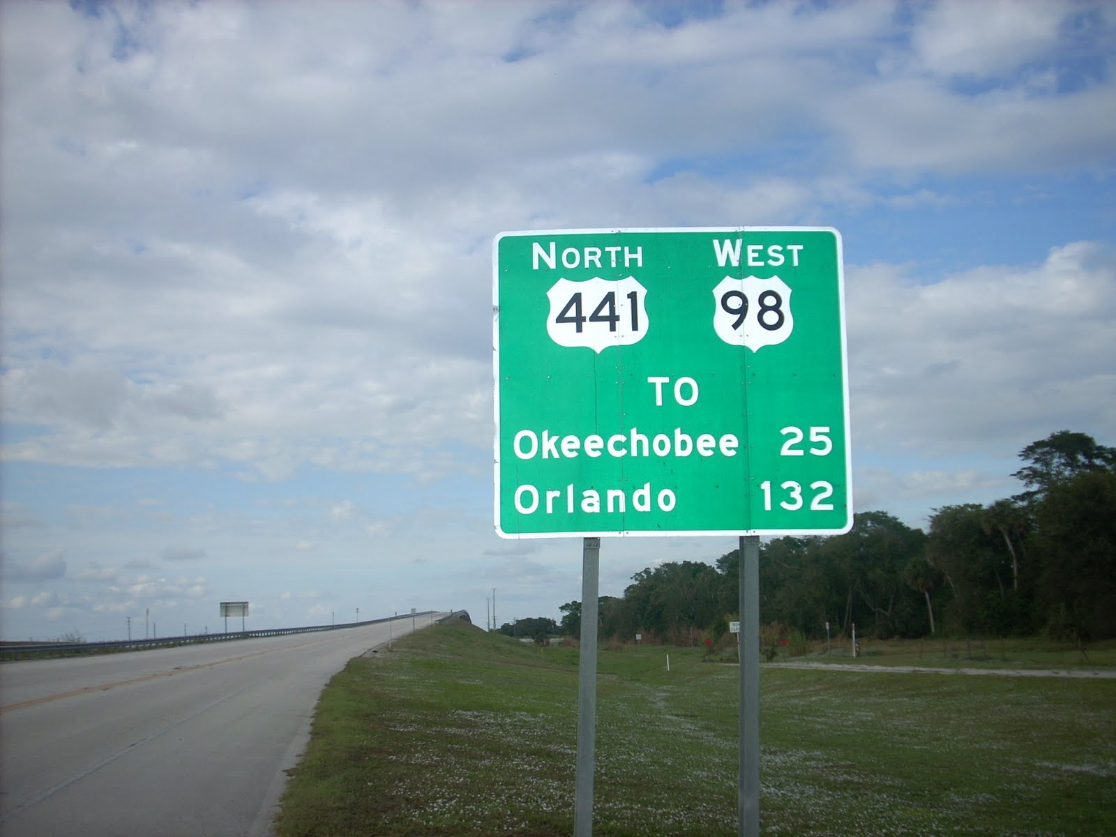
The marathon bicycle tourist in me also picked Port Mayaca for the launching site because it puts me in strategic position to complete the voyage’s two longest stretches by noon. It’s a 24-mile jaunt to Okeechobee on the lake’s northern point, then a 37-mile two-wheeled hike to Moore Haven on the lake’s southwest side. That’s about half the tour.
I settle into a smooth pedaling cadence as the first 10 miles on U.S. 441 are a glide to the Okeechobee County line. The pavement is fresh asphalt, and it’s comfy on the shoulder. It’s bumpier along Route 441 for the balance of the ride to Okeechobee.
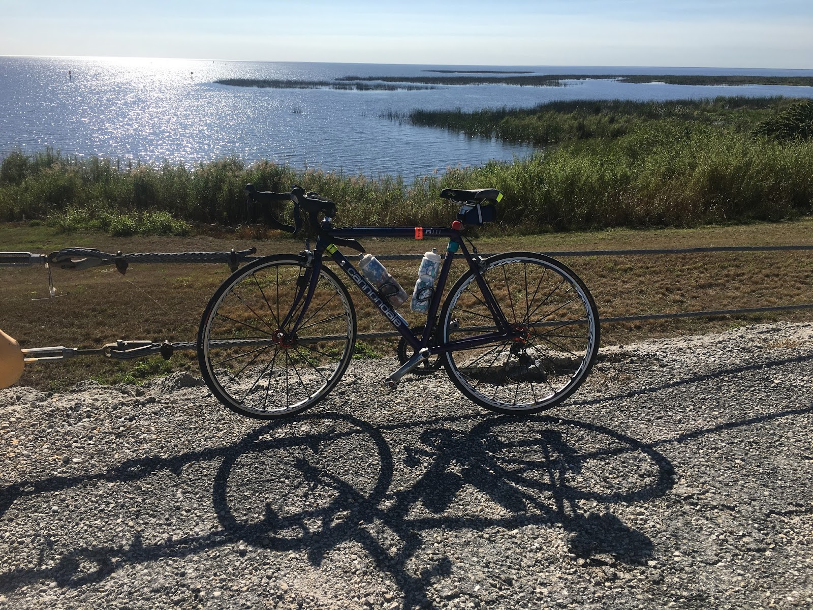
Cattle, fish camps, trailer parks and an occasional home keep me company. There are also a few access points back to the 750-square-mile lake — the second largest freshwater lake in the country. Its depth averages about 14 feet.
I can’t see the lake from the road because of a 34-foot-tall dike (officially called the Herbert Hoover Dike) that was built in 1928 after hurricane-powered flooding from the lake killed 2,000 people.
Okeechobee offers some places to carbo-load and quench my thirst, though downtown is actually a few miles from the lake. (For architectural buffs, there’s the Okeechobee County courthouse and government center. No central AC here — just breezeways to cool off visitors.)
I stop to rest, taking a healthy slug from my water bottle. With jersey pockets packed with fruits and sandwiches, and my water supply nowhere close to “E,” I’m back on the road for my haul to Moore Haven.
The road out of Okeechobee narrows — in fact, it’s shoulderless — as I start pedaling the loneliest part of the loop through Glades County. For someone living in frenetic South Florida, the flat, quiet, empty stretch of State Road 78 is welcome but also a bit disorienting.
No billboards, building eyesores or traffic. Few people live out here, and the motorists who do zoom by are courteous, offering me safe space inside the white line on the edge of the bumpy pavement.
A few miles outside Okeechobee there’s a spit of a community called Buckhead Ridge. About 15 miles down State Road 78 looms Lakeport, a bigger place that offers a few convenience stores.
I easily exceed 20 mph as tailwinds push me south and west to Lakeport. There’s something vastly fair about a circular route — sooner or later it will be payback time, and I will endure a harsh headwind when I head north and east.
It’s all quiet until the Moore Haven Correctional Facility comes into view as I approach U.S. 27 — the four-lane road that tourists followed from Tallahassee to South Florida before the age of the interstate. I turn left on Route 27 and ease two miles into Moore Haven.
Moore Haven is not very close to the Big O. I know not to expect any lake views or even glimpses of the grassy knoll that circles the body of water.
I quaff a half-gallon of water at the Burger King across from the Glades County Courthouse, then launch myself like a two-wheeled camel across a drawbridge (next to a giant span under construction) for a 15-mile spin to Clewiston in the heart of sugar country.
A plume of black smoke hazily drifts across the horizon. It smells of burning sugar cane fields. Outside of Moore Haven, there are wide-open vistas as the road cuts a swath through scrubland.
I cross into Hendry County. The 18-wheelers rumble by, but a wide shoulder offers a safe haven.
A handful of anywhere-in-America plazas, including a Wal-Mart and Kmart, greet me in Clewistown — “America’s Sweetest Town,” home to U.S. Sugar Corp. There are trailer parks, plazas, motels and a bevy of other businesses that have adopted Sugarland in their names.
I make a pit stop at the town’s historic jewel — the Clewiston Inn. A fine place for a cyclist to make a first-class bathroom visit. I peak in the dining room — indeed, an old-fashioned belle of a dining room. The buffet, I hear, is popular too.
It’s another 14 miles to South Bay, a quiet town and the lake’s southernmost point in Palm Beach County, where U.S. 27 takes a southern turn to Miami. I wave bye-bye to 27 and pick up State Road 715 for a foray into Belle Glade, then Pahokee.
Route 715 passes Glades Airport, a general aviation field that offers skydiving. I’ll stick to my prefered mode of travel, thank you.
Pahokee is the one town that is right next to the lake. Rows of towering royal palms standing sentinel along 715 lead me into Pahokee, where I meet U.S. 441 for the northern ride on the lake’s east side to Port Mayaca.
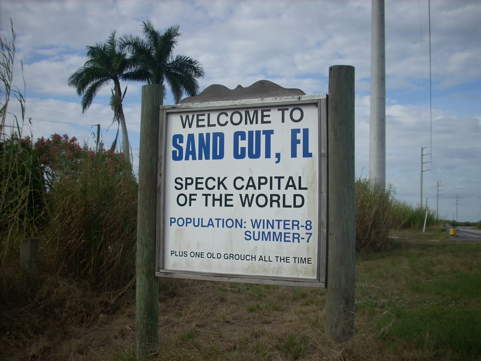
A few miles outside Pahokee is Canal Point, and the end of the trip is 14 miles away. I pop photographs of the “Sand Cut” town sign and enjoy the bucolic ride to Port Mayaca.
Sand Cut offers my favorite sign: “Welcome to Sand Cut, Fl. — Speck Capitol of the world — Population: Winter — 8 Summer — 7 Plus one old grouch all the time.”
Before turning into the Port Mayaca lock parking lot, I stop on the bridge spanning the St. Lucie Canal and look westward at the Big Lake. I take a mental snapshot. It’s nice to have a distinct memory of a ride that’s like no other in Florida.
*
Follow LBSportsBiz.com on Twitter and Instagram. Like LVSportsBiz.com on Facebook.